- / World & News
- / Countries of the World
- / Pakistan
Pakistan
Facts & Figures
-
President: Arif Alvi (2018)
Prime minister: Shehbaz Sharif (2022)
Land area: 297,636 sq mi (770,875 sq km); total area: 307,373 sq mi (796,095 sq km)1
Population (2022 est.): 242,923,845 (growth rate: 1.95%); birth rate: 26.48/1000; infant mortality rate: 53.98/1000; life expectancy: 69.67
Capital (2022 est.): Islamabad, 1.198 million
Largest cities: Karachi 16.840 million; Lahore 13.542 million; Faisalabad 3.625 million; Gujranwala, 2.353 million; Peshawar, 2.343 million (2022)
Monetary unit: Pakistan rupee
Principal languages: Punjabi 48%, Sindhi 12%, Saraiki (a Punjabi variant) 10%, Pashto (alternate name, Pashtu) 8%, Urdu (official) 8%, Balochi 3%, Hindko 2%, Brahui 1%, English (official; lingua franca of Pakistani elite and most government ministries), Burushaski, and other 8%
Ethnicity/race: Punjabi 44.7%, Pashtun (Pathan) 15.4%, Sindhi 14.1%, Saraiki 8.4%, Muhajirs 7.6%, Balochi 3.6%, other 6.3%
Religions: Muslim (official) 96.5% (Sunni 85-90%, Shia 10-15%), other (includes Christian and Hindu) 3.5% (2020 est.)
National Holiday: Republic Day, March 23
Literacy rate: 58% (2019 est.)
Economic summary GDP/PPP (2020 est.): $1,021,130,000,000; per capita $4,600. Real growth rate: 5.4%. Inflation: 9.3%. Unemployment: 6% plus substantial underemployment. Arable land: 27.6%. Agriculture: cotton, wheat, rice, sugarcane, fruits, vegetables; milk, beef, mutton, eggs. Labor force: 61.71 million; note: extensive export of labor, mostly to the Middle East, and use of child labor; agriculture 42.3%, industry 22.6%, services 35.1% (2017 est.). Industries: textiles and apparel, food processing, pharmaceuticals, construction materials, paper products, fertilizer, shrimp. Natural resources: land, extensive natural gas reserves, limited petroleum, poor quality coal, iron ore, copper, salt, limestone. Exports: $27.3 billion (2020 est.): textiles (garments, bed linen, cotton cloth, yarn), rice, leather goods, sports goods, chemicals, manufactures, carpets and rugs. Major trading partners (exports): United States 14%, China 8%, Germany 7%, United Kingdom 6% (2019). Imports: $51.07 billion (2020 est.): petroleum, petroleum products, machinery, plastics, transportation equipment, edible oils, paper and paperboard, iron and steel, tea. Major trading partners: China 28%, United Arab Emirates 11%, United States 5% (2019)
Communications: Telephones: main lines in use: 2,876,794 (2020); mobile cellular: 175,624,364 (2020). Broadcast media:media is government regulated; 1 dominant state-owned TV broadcaster, Pakistan Television Corporation (PTV), operates a network consisting of 5 channels; private TV broadcasters are permitted; to date 69 foreign satellite channels are operational; the state-owned radio network operates more than 40 stations; nearly 100 commercially licensed privately owned radio stations provide programming mostly limited to music and talk shows (2007). Internet hosts: 365,813 (2012). Internet users: 55,223,083 (2020).
Transportation: Railways: total: 11,881 km (2021). Roadways: total: 264,175 km; paved: 185,463 km (including 708 km of expressways); unpaved: 78,712 km (2021). Ports and harbors: Karachi, Port Muhammad bin Qasim. Airports: 151 (2021).
International disputes: various talks and confidence-building measures cautiously have begun to defuse tensions over Kashmir, particularly since the October 2005 earthquake in the region; Kashmir nevertheless remains the site of the world's largest and most militarized territorial dispute with portions under the de facto administration of China (Aksai Chin), India (Jammu and Kashmir), and Pakistan (Azad Kashmir and Northern Areas); UN Military Observer Group in India and Pakistan has maintained a small group of peacekeepers since 1949; India does not recognize Pakistan's ceding historic Kashmir lands to China in 1964; India and Pakistan have maintained their 2004 cease-fire in Kashmir and initiated discussions on defusing the armed standoff in the Siachen glacier region; Pakistan protests India's fencing the highly militarized Line of Control and construction of the Baglihar Dam on the Chenab River in Jammu and Kashmir, which is part of the larger dispute on water sharing of the Indus River and its tributaries; to defuse tensions and prepare for discussions on a maritime boundary, India and Pakistan seek technical resolution of the disputed boundary in Sir Creek estuary at the mouth of the Rann of Kutch in the Arabian Sea; Pakistani maps continue to show the Junagadh claim in India's Gujarat State; since 2002, with UN assistance, Pakistan has repatriated 3.8 million Afghan refugees, leaving about 2.6 million; Pakistan has sent troops across and built fences along some remote tribal areas of its treaty-defined Durand Line border with Afghanistan, which serve as bases for foreign terrorists and other illegal activities; Afghan, Coalition, and Pakistan military meet periodically to clarify the alignment of the boundary on the ground and on maps.

Index
- Pakistan Profile
- History
- News and Current Events
Geography
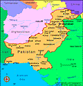
Pakistan is situated in the western part of the Indian subcontinent, with Afghanistan and Iran on the west, India on the east, and the Arabian Sea on the south. The name Pakistan is derived from the Urdu words Pak (meaning pure) and stan (meaning country). It is nearly twice the size of California.
The northern and western highlands of Pakistan contain the towering Karakoram and Pamir mountain ranges, which include some of the world's highest peaks: K2 (28,250 ft; 8,611 m) and Nanga Parbat (26,660 ft; 8,126 m). The Baluchistan Plateau lies to the west, and the Thar Desert and an expanse of alluvial plains, the Punjab and Sind, lie to the east. The 1,000-mile-long (1,609 km) Indus River and its tributaries flow through the country from the Kashmir region to the Arabian Sea.
Government
Military rule was instituted in Oct. 1999; a nominal democracy was declared in June 2001 by the ruling military leader, Pervez Musharraf.
History
Pakistan was one of the two original successor states to British India, which was partitioned along religious lines in 1947. For almost 25 years following independence, it consisted of two separate regions, East and West Pakistan, but now it is made up only of the western sector. Both India and Pakistan have laid claim to the Kashmir region; this territorial dispute led to war in 1949, 1965, 1971, 1999, and remains unresolved today.
What is now Pakistan was in prehistoric times the Indus Valley civilization (c. 2500–1700 BC). A series of invaders—Aryans, Persians, Greeks, Arabs, Turks, and others—controlled the region for the next several thousand years. Islam, the principal religion, was introduced in 711. In 1526, the land became part of the Mogul Empire, which ruled most of the Indian subcontinent from the 16th to the mid-18th century. By 1857, the British became the dominant power in the region. With Hindus holding most of the economic, social, and political advantages, the Muslim minority's dissatisfaction grew, leading to the formation of the nationalist Muslim League in 1906 by Mohammed Ali Jinnah (1876–1949). The league supported Britain in the Second World War while the Hindu nationalist leaders, Nehru and Gandhi, refused. In return for the league's support of Britain, Jinnah expected British backing for Muslim autonomy. Britain agreed to the formation of Pakistan as a separate dominion within the Commonwealth in Aug. 1947, a bitter disappointment to India's dream of a unified subcontinent. Jinnah became governor-general. The partition of Pakistan and India along religious lines resulted in the largest migration in human history, with 17 million people fleeing across the borders in both directions to escape the accompanying sectarian violence.
The New Republic
Pakistan became a republic on March 23, 1956, with Maj. Gen. Iskander Mirza as the first president. Military rule prevailed for the next two decades. Tensions between East and West Pakistan existed from the outset. Separated by more than a thousand miles, the two regions shared few cultural and social traditions other than religion. To the growing resentment of East Pakistan, West Pakistan monopolized the country's political and economic power. In 1970, East Pakistan's Awami League, led by the Bengali leader Sheik Mujibur Rahman, secured a majority of the seats in the national assembly. President Yahya Khan postponed the opening of the national assembly to skirt East Pakistan's demand for greater autonomy, provoking civil war. The independent state of Bangladesh, or Bengali nation, was proclaimed on March 26, 1971. Indian troops entered the war in its last weeks, fighting on the side of the new state. Pakistan was defeated on Dec. 16, 1971, and President Yahya Khan stepped down. Zulfikar Ali Bhutto took over Pakistan and accepted Bangladesh as an independent entity. In 1976, formal relations between India and Pakistan resumed.
Pakistan's first elections under civilian rule took place in March 1977, and the overwhelming victory of Bhutto's Pakistan People's Party (PPP) was denounced as fraudulent. A rising tide of violent protest and political deadlock led to a military takeover on July 5 by Gen. Mohammed Zia ul-Haq. Bhutto was tried and convicted for the 1974 murder of a political opponent, and despite worldwide protests he was executed on April 4, 1979, touching off riots by his supporters. Zia declared himself president on Sept. 16, 1978, and ruled by martial law until Dec. 30, 1985, when a measure of representative government was restored. On Aug. 19, 1988, Zia was killed in a midair explosion of a Pakistani Air Force plane. Elections at the end of 1988 brought longtime Zia opponent Benazir Bhutto, daughter of Zulfikar Bhutto, into office as prime minister.
A Shaky Government
In the 1990s, Pakistan saw a shaky succession of governments—Benazir Bhutto was prime minister twice and deposed twice and Nawaz Sharif three times, until he was deposed in a coup on Oct. 12, 1999, by Gen. Pervez Musharraf. The Pakistani public, familiar with military rule for 25 of the nation's 52-year history, generally viewed the coup as a positive step and hoped it would bring a badly needed economic upswing.
To the surprise of much of the world, two new nuclear powers emerged in May 1998 when India, followed by Pakistan just weeks later, conducted nuclear tests. Fighting with India again broke out in the disputed territory of Kashmir in May 1999.
Close ties with Afghanistan's Taliban government thrust Pakistan into a difficult position following the Sept. 11 terrorist attacks. Under U.S. pressure, Pakistan broke with its neighbor to become the United States' chief ally in the region. In return, President Bush ended sanctions (instituted after Pakistan's testing of nuclear weapons in 1998), rescheduled its debt, and helped to bolster the legitimacy of the rule of Pervez Musharraf, who appointed himself president in 2001.
On Dec. 13, 2001, suicide bombers attacked the Indian parliament, killing 14 people. Indian officials blamed the attack on Islamic militants supported by Pakistan. Both sides assembled hundreds of thousands of troops along their common border, bringing the two nuclear powers to the brink of war.
President Musharraf Extends Power
In 2002, voters overwhelmingly approved a referendum to extend Musharraf's presidency another five years. The vote, however, outraged opposing political parties and human rights groups who said the process was rigged. In August, Musharraf unveiled 29 constitutional amendments that strengthened his grip on the country.
Pakistani officials dealt a heavy blow to al-Qaeda in March 2003, arresting Khalid Shaikh Mohammed, the top aide to Osama bin Laden, who organized the 2001 terrorist attacks against the U.S. The search for bin Laden intensified in northern Pakistan following Mohammed's arrest.
In Nov. 2003, Pakistan and India declared the first formal cease-fire in Kashmir in 14 years. In April 2005, a bus service began between the two capitals of Kashmir—Srinagar on the Indian side and Pakistan's Muzaffarabad—uniting families that had been separated by the Line of Control since 1947.
Abdul Qadeer Khan, the father of Pakistan's nuclear bomb, was exposed in Feb. 2004 for having sold nuclear secrets to North Korea, Iran, and Libya. Musharraf had him apologize publicly, and then pardoned him. While much of the world reviled him for this unconscionable act of nuclear proliferation, the scientist remains a national hero in Pakistan. Khan claimed that he alone and not Pakistan's military or government was involved in the selling of these ultraclassified secrets; few in the international community have accepted this explanation.
A Relationship with the Taliban
Pakistan has launched major efforts to combat al-Qaeda and Taliban militants, deploying 80,000 troops to its remote and mountainous border with Afghanistan, a haven for terrorist groups. More than 800 soldiers have died in these campaigns. Yet the country remains a breeding ground for Islamic militancy, with its estimated 10,000–40,000 religious schools, or madrassas. In late 2006 and into 2007, members of the Taliban crossed into eastern Afghanistan from Pakistan's tribal areas. The Pakistani government denied that its intelligence agency has supported the Islamic militants, despite contradictory reports from Western diplomats and the media.
In Sept. 2006, President Musharraf signed a controversial peace agreement with seven militant groups, who call themselves the “Pakistan Taliban.” Pakistan's army agreed to withdraw from the area and allow the Taliban to govern themselves, as long as they promise no incursions into Afghanistan or against Pakistani troops. Critics said the deal hands terrorists a secure base of operations; supporters counter that a military solution against the Taliban is futile and will only spawn more militants, contending that containment is the only practical policy. That agreement came under fire in the U.S. in July 2007 with the release of a National Intelligence Estimate. The report concluded that al-Qaeda has gained strength in the past two years and that the United States faces "a persistent and evolving terrorist threat over the next three years." The report also said the deal has allowed al-Qaeda to flourish.
An earthquake with a magnitude of 7.6 struck Pakistani-controlled Kashmir on Oct. 8, 2005. More than 81,000 people were killed and 3 million left homeless. About half of the region’s capital city, Muzaffarabad, was destroyed. The disaster hit at the onset of the Himalayan winter. Many rural villages were too remote for aid workers to reach, leaving thousands vulnerable to the elements.
Musharraf's Political Troubles
In March 2007, President Musharraf suspended Chief Justice Iftakar Mohammed Chaudhry, accusing him of abuse of power and nepotism. Supporters of Chaudhry took the streets in protest, claiming the move was politically motivated. In May, 39 people were killed in Karachi when dueling rallies—those in support of Chaudhry and others of the government—turned violent. Justice Chaudhry had agreed to hear cases involving disappearances of people believed to have been detained by intelligence agencies and constitutional challenges involving Musharraf’s continued rule as president and head of the military. Chaudhry challenged his suspension in court, and in July, Pakistan’s Supreme Court ruled that President Musharraf acted illegally when he suspended Chaudhry. The court reinstated him.
Radical Islamist clerics and students at Islamabad's Red Mosque, who have been using kidnappings and violence in their campaign for the imposition of Shariah, or Islamic law, in Pakistan, exchanged gunfire with government troops in July 2007. After the initial violence, the military laid seige to the mosque, which held nearly 2,000 students. Several students escaped or surrendered to officials. The mosque's senior cleric, Maulana Abdul Aziz was caught by officials when attempting to escape. After negotiations between government officials and mosque leaders failed, troops stormed the compound and killed Abdul Rashid Ghazi, who took over as chief of the mosque after the capture of Aziz, his brother. More than 80 people died in the violence. Violence in remote tribal areas intensified after the raid. In addition, the Taliban rescinded the cease-fire signed in Sept. 2006, and a series of suicide bombings and attacks followed.
Musharraf's political troubles intensified in the late summer. In August, the Supreme Court ruled that former prime minister Nawaz Sharif could return to Pakistan from exile in Saudi Arabia. Both Sharif and Benazir Bhutto, also a former prime minister, had sought to challenge Musharraf's role as military leader and president. Days after the ruling, Bhutto revealed that Musharraf had agreed to a power-sharing agreement, in which he would step down as army chief and run for reelection as president. In exchange, Bhutto, who had been living in self-imposed exile for eight years, would be allowed to return to Pakistan and run for prime minister. Aides to Musharraf, however, denied that an agreement was reached. Shortly after, however, Musharraf said that if elected to a second term as president, he will step down from his post as army chief before taking the oath of office. Some opposition leaders, however, questioned whether he would follow through on his promise. In September, Sharif was arrested and deported hours after he returned to Pakistan.
On Oct. 6, Musharraf was easily reelected to a third term by the country's national and provincial assemblies. The opposition boycotted the vote, however, and only representatives from the governing party participated in the election. In addition, the Supreme Court said the results will not be formalized until it rules whether Musharraf was constitutionally eligible to run for president while still head of the military.
The Return of Benazir Bhutto
Bhutto returned to Pakistan on Oct. 18 amid much fanfare and jubilation from her supporters. The triumphant mood gave way to panic when a suicide bomber attacked her convoy, killing as many as 135 people. Bhutto survived the attack.
On Nov. 3, Musharraf declared a state of emergency, suspended Pakistan's constitution, and fired Chief Justice Iftakar Mohammed Chaudhry and the other judges on the Supreme Court. In addition, police arrested at least 500 opposition figures. Political opponents said Musharraf had in effect declared martial law. Analysts suggested that Musharraf was trying to preempt an upcoming ruling by the Supreme Court, which was expected to declare he could not constitutionally run for president while head of the military. Musharraf, however, said he acted to stem a rising Islamist insurgency and to "preserve the democratic transition.” On Nov. 5, thousands of lawyers took to the streets to protest the emergency rule. Many clashed with baton-wielding police. As many as 700 lawyers were arrested, including Chaudhry, who was placed under house arrest. Under pressure from U.S. officials, Musharraf said parliamentary elections would take place in Jan. 2008.
On Nov. 9, thousands of police officers barricaded the city of Rawalpindi, the site of a protest planned by Bhutto. She was later placed under house arrest. On Nov. 15, the day that Parliament's five-year term ended, Musharraf swore in a caretaker government, with Mohammedmian Soomro, the chairman of Pakistan's senate, as prime minister. He also lifted Bhutto's house arrest. Later that month, the Supreme Court, stacked with judges loyal to Musharraf, dismissed the case challenging the constitutionality of Musharraf being elected president while head of the military. Former prime minister Nawaz Sharif returned to Pakistan on Nov. 25 after eight years in exile and demanded that Musharraf lift the emergency rule and reinstate the Supreme Court justices that were dismissed on Nov. 3. Sharif, who has refused to share power with Musharraf, poses a formidable political threat to Musharraf.
Musharraf stepped down as military chief on Nov. 28, the day before being sworn in as a civilian president. Gen. Ashfaq Parvez Kayani, the former head of Pakistan’s intelligence agency, Inter-Services Intelligence, took over as army chief. Since he no longer controls the military, Musharraf's power over Pakistan has been significantly diminished.
Musharraf ended emergency rule on Dec. 14 and restored the constitution. At the same time, however, he issued several executive orders and constitutional amendments that precluded any legal challenges related to his actions during and after emergency rule and barred the judges whom he fired from resuming their positions. "Today I am feeling very happy that all the promises that I have made to the people, to the country, have been fulfilled," he said.
Bhutto's Assassination and Successor
Benazir Bhutto was assassinated in a suicide attack on Dec. 27, 2007, at a campaign rally in Rawalpindi. President Pervez Musharraf blamed al Qaeda for the attack, which killed 23 other people. Bhutto's supporters, however, accused Musharraf's government of orchestrating the combination bombing and shooting. Rioting throughout the country followed the attack, and the government shut down nearly all the country's services to thwart further violence. Bhutto had criticized the government for failing to control militants who have been unleashing terrorist attacks throughout Pakistan. In the wake of the assassination, Musharraf postponed parliamentary elections, which had been scheduled for Jan. 8, 2008, until Feb. 18.
Scotland Yard investigators reported in February 2008 that Bhutto died of an injury to her skull. They said she hit her head when the force of a suicide bomb tossed her. Bhutto's supporters, however, insist she died of a bullet wound. Also in February, two Islamic militants who had been arrested in connection to the assassination admitted that they armed the attacker with a suicide vest and a pistol.
In the parliamentary elections in February, Musharraf's party, the Pakistan Muslim League-Q, which has been in power for five years, suffered a stunning defeat, losing most of its seats. The opposition Pakistan Peoples Party, which was led by Bhutto until her assassination and is now headed by her widow, Asif Ali Zardari, won 80 of the 242 contested seats. The Pakistan Muslim League-N, led by Sharif, took 66 seats. Musharraf party's won just 40. His defeat was considered a protest of his attempts to rein in militants, his coziness with President Bush, and his dismissal of Supreme Court Chief Justice Iftikhar Muhammad Chaudhry. The Pakistan People's Party and the Pakistan Muslim League-N formed a coalition government. In March, Parliament elected Fahmida Mirza as speaker. She is the first woman in Pakistan elected to the position.
In March, Zardari selected Yousaf Raza Gillani, who served as speaker of Parliament in the 1990s under Benazir Bhutto, as prime minister. One of Gillani's first moves as prime minister was to release the Supreme Court justices that Musharraf ousted and detained in late 2007.
The new government signaled a change of course with the announcement that it would negotiate with militants who live and train in Pakistan's remote tribal areas. The policy met resistance from the United States, which, with approval from Musharraaf, has stepped up its attacks against the militants.
In May, the coalition government reached a compromise agreement to reinstate the Supreme Court justices who were dismissed in Nov. 2007 by Musharraf. The agreement fell apart days later, when the Pakistan Muslim League-N said it would withdraw from the cabinet because the Pakistan Peoples Party insisted on retaining the judges who replaced those who were dismissed by Musharraf. In addition, the two parties disagreed on how to reinstate the justices. Sharif wanted the judges immediately reinstated by executive order; Asif Ali Zardari, the leader of the Pakistan People's Party preferred it be done through Parliament, a process that may be protracted.
Fighting Breaks Out in Kashmir
Skirmishing along Kashmir's Line of Control broke out over the summer of 2008, after more than four years of relative calm. The problems arose after authorities in Indian-controlled Kashmir transferred 99 acres of land to a trust that runs a Hindu shrine, called Amarnath. Muslims launched a series of protests. The government rescinded the order, which outraged Hindus. About 40 people were killed in the protests and counterdemonstrations, which involved several hundred thousand people. Despite the hostilities, a trade route between India and Pakistan across the line of control opened in October for the first time in 60 years.
U.S. intelligence agencies determined that Pakistan's Directorate of Inter-Services Intellgence (ISI) helped to carry out an attack outside the Indian Embassy in Kabul in July that killed more than 50 people, including two Indian diplomats. The attack occurred while Gillani was in the United States meeting with President Bush. Officials also said that the ISI has been tipping off militants about U.S. operations against them.
In August, the governing coalition announced plans to "immediately initiate impeachment proceedings" against President Musharraf on charges of violating the constitution and misconduct. The charges stem from his actions in Nov. 2007, when he suspended the country's constitution and fired Chief Justice Iflikhar Muhammad Chaudhry and the other judges on the Supreme Court. Days later, on Aug. 18, Musharraf resigned as president. "Not a single charge can be proved against me," he said, adding that he was stepping down to put the country's interests above "personal bravado." Muhammad Mian Soomro, the chairman of the Senate, was named acting president.
On Aug. 25, Sharif withdrew his party, the Pakistan Muslim League-N, from the governing coalition, saying he could no longer work with Zardari. He said Zardari went back on pledges to restore Chaudhry to his role as chief justice of the Supreme Court and to work with Sharif to select a presidential candidate. Instead, Zardari announced plans to run for president.
A New President and U.S. Involvement
In September 2008, the two houses of Parliament elected Zardari president by a wide margin. He faces the overwhelming task of rooting out members of al-Qaeda and the Taliban, who control much of the country's tribal areas. He also promised to improve the relationship between Parliament and the presidency. "Parliament will be sovereign,” he said. “This president shall be subservient to the Parliament.”
The Pakistani military launched a three-week-long cross-border air assault into Afghanistan's Bajaur region throughout August, which resulted in more than 400 Taliban casualties. The continuous airstrikes forced many al-Qaeda and Taliban militants to retreat from towns formally under their control. However, the Pakistani government declared a cease-fire in the Bajaur region for the month of September in observance of Ramadan, raising fears that the Taliban will use the opportunity to regroup.
In its first acknowledged ground attack inside Pakistan, U.S. commandos in September raided a village that was home to al-Qaeda militants in the tribal region near the border with Afghanistan. The New York Times later reported that in July, President Bush authorized U.S. Special Operations troops to launch ground attacks inside Pakistan without seeking approval from the Pakistani government. The report said the U.S. would, however, alert Pakistan to attacks. A top Pakistani military leader said the army will not tolerate such attacks.
A truck bomb exploded outside the popular Marriott Hotel in Islamabad in September 2008, killing more than 50 people and wounding hundreds. The bomb went off as government leaders, including the president and prime minister, were dining a few hundred yards away, at the prime minister's residence. It is one of the worst terrorist attacks in Pakistan's history.
About 170 people were killed and about 300 wounded in a series of attacks that began on Nov. 26 on several landmarks and commercial hubs in Mumbai, India. Indian officials said ten gunmen carried out the attack, which was stunning in its brutality and duration; it took Indian forces three days to end the siege. While a previously unknown group, Deccan Mujahedeen, initially claimed responsibility for the attack, Indian and U.S. officials said they have evidence that the Pakistan-based militant Islamic group Lashkar-e-Taiba was involved. Lashkar-e-Taiba, which translates to Army of the Pure, was established in the late 1980s with the assistance of Pakistan's spy agency, Inter-Services Intellgence, to fight Indian control of the Muslim section of Kashmir. The accusation further strained an already tense relationship between the two countries. While President Asif Ali Zardari first denied that Pakistani citizens were involved in the attack, in December, Pakistan officials raided a camp run by Lashkar-e-Taiba in Muzaffarabad, the capital of Pakistan-controlled Kashmir, and arrested several militants. In Feb. 2009, Pakistan's interior minister acknowledged that "some part of the conspiracy" had occurred in Pakistan. In August, the only surviving suspect in the bombings, Muhammad Ajmal Qasab, a Pakistani citizen, pleaded guilty in court to his role in the attack, reversing his earlier plea.
Also in February, the government agreed to implement a system of Islamic law in the Swat valley and a truce with the Taliban regime. This accommodation will essentially provide the Taliban with a safe haven in Pakistan, effectively ending the government's attempts to stop the insurgency. Taliban militants now control approximately 70% of the country.
A group of 12 gunmen in Pakistan attacked the national cricket team of Sri Lanka and their police escorts in March. Six policemen were killed in the attack, as well as two bystanders. Six cricketers were wounded. Several countries' teams have refused to travel to Pakistan for games, citing their team members' safety. The Sri Lankan team is the first to travel to the country in over a year.
Government Assaults on Taliban Meet Strong Resistance
As violence increased in Afghanistan, with militants pouring into the country from Pakistan, President Obama stepped up the pressure on Zardari to take military action against the Taliban and al Qaeda. At the same time, Pakistanis had been expressing deep frustration over the burgeoning authority the Taliban had begun to display throughout the country. The insurgency's growing strength was highlighted in April, when it took control of Buner, a district only 70 miles outside the capital, Islamabad.
Zardari, perhaps wary of losing U.S. support-both financial and political-and sensing popular unrest at home, launched offensives against Taliban insurgents. The first occurred in May in the Swat Valley. At least 22,000 Pakistani troops were sent to fight the insurgency.
The U.S. and Pakistan scored an important victory over the Taliban with the assassination of Baitullah Mehsud, the leader of the Taliban in Pakistan, in August in South Waziristan. He died in a C.I.A. drone strike. Mehsud was blamed for the assassination of Benazir Bhutto, the terrorist attack on the Marriott Hotel in Islamabad, and dozens of other suicide bombings. Hakimullah Mehsud assumed the leadership role.
The Supreme Court ruled in July 2009 that Musharraf's declaration of a state of emergency was unconstitutional. Zardari followed the ruling with an order to suspend the judges who were appointed during the state of emergency.
In late October, the military targeted the Taliban in the tribal area of South Waziristan. The incursion met strong resistance and forced tens of thousands of civilians to flee their homes. The Taliban retaliated with a series of terrorist attacks that targeted government buildings and crowded areas, killing hundreds of people and proving that the government was in for a protracted battle against fierce and stubborn opponent. The government, however, dealt several blows to the Taliban's leadership in early 2010, capturing the group's deputy leader, Mullah Abdul Ghani Baradar, in January, and then two regional governors—Mullah Abdul Salam of Kunduz and Mullah Mir Mohammed of Baghlan—in February.
Zardari turned over control of the Pakistan's nuclear weapons to Prime Minister Gilani in November 2009. The move, an apparent concession to Zardari's critics, will not have much effect of the oversight of Pakistan's nuclear arsenal. The president showed further vulnerability in December when the Supreme Court ruled that the amnesty granted to him and others by the former president Musharraf was unconstitutional. Zardari again bowed to pressure in April 2010 when he introduced a proposal for consitutional reform that included provisions that would diminish the role of the presidency.
The whistle-blower website WikiLeaks released 92,000 classified U.S. military documents in July 2010 that reinforced the widely held perception that the ISI, Pakistan's intelligence agency, has been playing both sides in the war against the Taliban and militant groups, clandestinely supporting the insurgents in their fight against allied troops in Afghanistan while also cooperating with the U.S.
Floods Ravage the Country
Much of Pakistan was devastated in July and August 2010 by the country's worst flooding in 80 years. The floods started in northwest province of Baluchistan and spread to Punjab and beyond, reaching as far as the southern province of Sindh. The northwest had already been hit hard by years of war with the Taliban. Much of the country's infrastructure was destroyed, along with farmland, livestock, homes and supplies of food and clean water. President Zardari was criticized for traveling to Europe while the country suffered grievously. The floods displaced 20 million people and killed more than 1,600.
In April 2012, Pakistan tested an intermediate-range ballistic missile that can carry a nuclear warhead. Just a week earlier, India successfully launched the Agni 5, a long-range ballistic missile that can reach Beijing and Shanghai, China, and can also deliver a nuclear warhead. Both Pakistan and India denied that the tests were intended as brinkmanship toward the other. India said the exercise was a response to China's recent investment in its military and its growing assertiveness on the military front, while Pakistan said its exercise would "further strengthen and consolidate Pakistan's deterrence capabilities."
Osama bin Laden Is Killed; Ties with U.S. Further Strained
On May 1, 2011, U.S. troops and CIA operatives shot and killed Osama bin Laden in Abbottabad, Pakistan, a city of 500,000 people that houses a military base and a military academy. A gun battle broke out when the troops descended upon the building in which bin Laden was located, and bin Laden was shot in the head. News of bin Laden's death brought cheers and a sense of relief worldwide.
"For over two decades, Bin Laden has been Al Qaeda's leader and symbol," said President Barack Obama in a televised speech. "The death of bin Laden marks the most significant achievement to date in our nation's effort to defeat Al-Qaeda. But his death does not mark the end of our effort. There's no doubt that Al-Qaeda will continue to pursue attacks against us. We must and we will remain vigilant at home and abroad."
While Bin Laden's demise was greeted with triumph in the United States and around the world, analysts expressed concern that Al-Qaeda may seek retaliation. U.S. embassies throughout the world were put on high alert, and the U.S. State Department issued a warning for travelers visiting dangerous countries, instructing them "to limit their travel outside of their homes and hotels and avoid mass gatherings and demonstrations." Some Afghan officials expressed concern that bin Laden's death might prompt the U.S. to withdraw troops from Afghanistan and said the U.S. should maintain a presence there because terrorism continues to plague the country and the region.
"The killing of Osama should not be seen as mission accomplished," former interior minister Hanif Atmar told the New York Times. "Al Qaeda is much more than just Osama bin Laden." Dr. Ayman al-Zawahiri, an Egyptian doctor who is al-Qaeda's theological leader, will likely succeed bin Laden.
The fact that bin Laden was hiding in Pakistan in a compound located in close proximity to a military base will likely strain the already distrustful relationship between the U.S. and Pakistan. Indeed, Pakistan has long denied that bin Laden was hiding within its borders, and the U.S. has provided Pakistan with about $1 billion each year to fight terrorism and to track down bin Laden. Inside Pakistan, officials and legislators questioned how the military did not detect several U.S. helicopters entering and leaving Abbottabad and wondered about its ability to protect the country and its nuclear arsenal.
In September 2011, members of the Haqqani network, a group allied with the Taliban, launched a brazen attack in Kabul, Afghanistan, firing on the U.S. embassy, the headquarters of the NATO-led International Security Assistance Force, and other diplomatic outposts. Nearly 30 people were killed, including 11 militants. The U.S. later accused Pakistan's spy agency, the Directorate for Inter-Services Intelligence (ISI), of helping the Haqqani network plan the attack. In fact, Adm. Mike Mullen, the chairman of the U.S. Joint Chiefs of Staff, said the Haqqani network "acts as a veritable arm of Pakistan's Inter-Services Intelligence Agency." U.S. secretary of state Hillary Clinton warned Pakistani officials in October that if they failed to act against insurgent groups like the Haqqani network that attack and kill Americans, then the U.S. would attack them. The Haqqani orchestrated seven synchronized attacks in April in Afghanistan, targeting Parliament and the Green Zone in Kabul and three provinces (Nangarhar, Paktia, and Logar). The assaults highlighted the network's increasing sophistication and effectiveness.
Ties between the U.S. and Pakistan hit a new low at the end of November after a NATO cross-border airstrike from Afghanistan on two positions in northwest Pakistan killed 25 Pakistani soldiers. Civilians and government officials were outraged by the attack and expressed little patience for the continued U.S.-led war on terror being fought their country's border. The circumstances that led to the attack were in dispute, and NATO launched an investigation. Pakistan responded by demanding that the CIA halt its drone program at the Shamsi Air Base in western Afghanistan and shut down supply routes into Afghanistan. Pakistan reopened the route in the summer of 2012, after the U.S. offered a qualified apology for the friendly fire deaths.
Pakistan Faces Internal Strife
In April 2012, Pakistan tested an intermediate-range ballistic missile that can carry a nuclear warhead. Just a week earlier, India successfully launched the Agni 5, a long-range ballistic missile that can reach Beijing and Shanghai, China, and can also deliver a nuclear warhead. Both Pakistan and India denied that the tests were an act of brinkmanship. India said the exercise was a response to China's recent investment in its military and its growing assertiveness on the military front, while Pakistan said its exercise would "further strengthen and consolidate Pakistan's deterrence capabilities."
The relationship between the civilian government, the military, and the judiciary has historically been antagonistic and based on mistrust, and such strife was on display in late 2011 and into 2012. Many observers concluded that the military wanted to oust the governing coalition of Prime Minister Gilani and President Zardari, but rather than stage a coup, it attempted to use legal channels to force them out of office. First, shortly after Osama bin Laden was killed, the U.S. received an anonymous memo from a Pakistani source, reportedly an ally of the government, asking for U.S. help in tamping down the military's influence and to discourage it from attempting a coup. At the military's request, the Supreme Court ordered the government to investigate the source of the memo.
In another matter, the Supreme Court requested that the government allow the Swiss to pursue money-laundering charges against President Zardari that date back to the 1990s. The government, however, refused, citing presidential immunity, and the Supreme Court threatened to hold Prime Minister Gilani in contempt of court. In February, the Supreme Court indicted Gilani on charges of contempt of court. He was convicted in May, but was spared any jail time. The opposition called for his resignation. In June Supreme Court Chief Justice Iftikhar Muhammad Chaudhry ordered that Gilani step down. The court continued to intervene in the politics of the country. The day after President Zardari announced that former health minister—and ally, Makhdoom Shahabuddin, was his choice as Gilani's successor, the military ordered the arrest of Shahabuddin on drug charges. Gilani's son was also arrested. Parliament then elected Raja Pervez Ashraf, a former cabinet minister, as prime minister.
When he served as water and power minister, Ashraf was accused of corruption. The accusation came back to haunt him in January 2013, when Supreme Court Chief Justice Iftikhar Muhammad Chaudhry issued an order for his arrest and an investigation into the corruption charges. The order came in the middle of a series of large anti-government protests led by Muhammad Tahir-ul Qadri, a populist Sufi cleric, who emerged onto the political scene in late 2012 and quickly massed an enormous loyal following. The timing of the arrest order caused many to wonder if Chaudhry and Qadri were colluding to further intimidate Zardari’s Pakistan Peoples Party.
Taliban members shot 14-year-old Malala Yousafzai in the head and neck in October 2012 in the Swat Valley. The shooting occurred while Yousafzai, an internationally known activist for girls' rights to an education, was on her way home on a school bus filled with children. All three girls survived, but Yousafzai suffered critical injuries. She was airlifted to a hospital in England for treatment. Ehsanullah Ehsan, a Taliban spokesman, confirmed that Yousafzai was the target due to her outspokenness against the Taliban and her determination to get an education. Ehsan said, "She has become a symbol of Western culture in the area; she was openly propagating it. Let this be a lesson." The shooting highlighted the Taliban's scorched-earth tactics to deny women rights, particularly to an education.
Pervez Musharraf, who took power in a 1999 coup and served as president until 2008, returned to Pakistan in March 2013 from self-imposed exile in London to announce plans to run in May's election. His return lacked much fanfare, and he faces charges related to the murder of Benazir Bhutto and over his 2007 implementation of house arrest on Chief Justice Iftakar Mohammed Chaudhry and other justices. In August, Musharraf was indicted in the murder of Bhutto. He was charged with murder and conspiracy to murder. He pleaded not guilty to the charges.
Nawaz Sharif Returns to Post as Prime Minister in Historic Election
Former prime minister Nawaz Sharif of the Pakistan Muslim League dominated parliamentary elections in May 2013. Trailing were the Movement for Justice Party (PTI), led by cricket star Imran Khan, and the governing Pakistan People's Party (PPP). The historic election marked the first time in the coup-prone country that a civilian government served out its full five-year term and transferrred power after a democratic election. Khan, who appealed to younger voters, was expected to poll much better and alleged the election was marred by vote-rigging. Sharif formed alliances with smaller parties to establish a majority, and Parliament elected him prime minister in June. He served as prime minister from 1990 to 1993 and 1997 to 1999. A fiscal conservative who favors deregulation, Sharif campaigned on promises to boost the economy and curtail Pakistan's cooperation with the U.S. in its war on terrorists. Upon taking office, he called on the U.S. to halt its drone strikes into tribal areas on Pakistani soil. His request came days after a U.S. drone strike killed Wali-ur-Rehman, the Pakistan Taliban's second highest-ranking leader.
A 336-page document was leaked in July 2013, reviving questions about Pakistani government collusion in the hiding of Osama bin Laden. Compiled from the testimony of more than 200 witnesses—including military and civilian officials and the three widows of Bin Laden—the report called out the government's "culpable incompetence and negligence," but fell short of implicating the government in active partnering with Al-Qaeda.
The national and provincial parliaments elected Mamnoon Hussain president in July 2013. Hussain, of the ruling Pakistan Muslim League, defeated Wajihuddin Ahmad, a former Supreme Court justice. The opposition Pakistan People's Party (PPP) boycotted the election, saying there was not enough time to campaign before the election. Hussain is a businessman with little political experience beyond briefly serving as governor of Sindh Province in 1999. Zardari is the first democratically elected president to finish his term and hand power to a successor. Since Zardari returned many of his powers to parliament in 2010, the role of president is largely ceremonial.
In September 2013, two suicide bombers linked to the Taliban attacked the All Saints Church in Peshawar, killing more than 80 people and destroying the historic church. It was the deadliest attack against Christians in Pakistan's history. Shiites, also a religious minority in Pakistan, have also been targeted by the Taliban in the past year. The ongoing attacks by the Taliban prompted many to question if the government should move ahead with plans to begin negotiations with the Taliban.
On September 23, 2013, a 7.7 magnitude earthquake hit Baluchistan, an area of deserts and mountains in Pakistan. The earthquake caused hundreds of mud houses to collapse on residents. At least 327 people were killed.
Taliban Leader Killed in a Drone Strike; Pakistan Launches Offensive Against Militants
The U.S. achieved an important victory over the Taliban with the November 2013 assassination of Hakimullah Mehsud, the leader of the Taliban in Pakistan. He died in a CIA drone strike in Danday Darpa Khel, a militant stronghold in North Waziristan. While the government expressed outrage that the U.S. overstepped its boundaries, many citizens indicated they were relieved about the death of a man whose group has destabilized and terrorized the country. The Pakistani Taliban is responsible for the death of thousands of Pakistanis mostly through suicide bombings and has been battling the country's army in the tribal belt. The drone program has come under fire in Pakistan and in the U.S., as opponents say the attacks have claimed far too many civilians. However, a report by Pakistan's defense ministry released days before Mehsud's death found that since 2008, the drone strikes had killed 2,160 militants and 67 civilians—far fewer civilians than expected. The government also said Mehsud's death may thwart plans to hold peace talks with the Taliban.
Days after Mehsud's death, the Taliban selected Mullah Fazlullah as their new leader. Fazlullah, known for his brutal tactics and as an ideologue, organized the attack on 14-year-old peace activist Malala Yousafzai. He said the Taliban would not enter into peace talks with the government.
Prime Minister Sharif named Lt. Gen. Raheel Sharif as head of the miliatry in November, just days before the retirement of Ashfaq Parvez Kayani. The new military chief, a career infantry soldier, is not related to the prime minister. In recent history, the army chief has been considered the most powerful figure in the country.
Peace talks between the government and Tehreek-e-Taliban Pakistan (TTP), the the umbrella organization of the country's network of militants, began in February 2014 but quickly fell apart without making much progress. The military then began a bombing campaign of militant hideouts in North Waziristan and the Khyber region. In March, the TTP reached out to the government, announcing a one-month cease-fire and a resumption of talks. The group ordered all militant groups in Pakistan to observe the cease-fire.
Sharif accepted an invitation to attend the May 2014 inauguration of Narendra Modi as India's prime minister. The two shook hands and exchanged pleasantries at the ceremony, a sign that there may be a thaw in relations between India and Pakistan.
The Pakistani Taliban launched a brazen overnight attack at Karachi's Jinnah International Airport, the largest and busiest airport in the country, in early June 2014. Ten militants infiltrated the airport and engaged in a gun battle with airport security and police. Thirty-six people were killed, including all ten gunmen. Taliban spokesman Shahidullah Shahid said the attack was "a response to the recent attacks by the government" and that such assaults would continue. He also said, "The main goal of this attack was to damage the government." The assault likely dealt a fatal blow to any hopes of peace negotiations between the government and the Taliban.
The military responded by attacking several militant hide-outs in the North Waziristan tribal region, a move long sought by the U.S. The offensive killed about 1,800 militants. The attacks, however, resulted in the mass exodus of some 1 million civilians.
Taliban Attack on an Army-Run School Kills Dozens
Imran Khan, the cricket star who lost to Prime Minister Sharif in the 2013 election, and cleric Muhammad Tahir-ul Qadri called on their supporters in Aug. 2014 to protest against Sharif and demand his resignation, saying the 2013 election was rigged. International observers had deemed the election largely fair. Protesters took to the streets of Islamabad, and after several days boldly entered the city's "red zone," which houses Parliament, the prime minister's house, and foreign embassies. Sharif restrained police, allowing protesters to proceed into the area. The protests turned violent on Aug. 31, when the demonstrators attempted to attack the prime minister's residence. Police used rubber bullets and tear gas on protesters, who attacked police with sticks and rocks. Three protesters died in the violence.
The Taliban attacked the Army Public School and Degree College in Peshawar, in northwest Pakistan, in mid-December. About 145 people were killed in the seige, including more than 100 children. It was the most brazen and deadly attack by the Taliban in years. A Taliban spokesman said the attack was in retaliation for the military's offensive against militant hideouts in North Waziristan, which resulted in the death of about 1,800 militants.
See also Encyclopedia: Pakistan .
U.S. State Dept. Country Notes: Pakistan
Statistics Division www.statpak.gov.pk