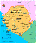
Sierra Leone
Facts & Figures
-
President: Ernest Koroma (2007)
Land area: 27,653 sq mi (71,621 sq km); total area: 27,699 sq mi (71,740 sq km)
Population (2014 est.): 5,743,725 (growth rate: 2.33%); birth rate: 37.4/1000; infant mortality rate: 73.29/1000; life expectancy: 57.39; density per sq mi: 205.6
Capital and largest city (2011 est.): Freetown, 941,000
Monetary unit: Leone
Languages: English (official), Mende (southern vernacular), Temne (northern vernacular), Krio (lingua franca)
Ethnicity/race: Temne 35%, Mende 31%, Limba 8%, Kono 5%, Kriole 2% (descendants of freed Jamaican slaves who were settled in the Freetown area in the late-18th century; also known as Krio), Mandingo 2%, Loko 2%, other 15% (includes refugees from Liberia's recent civil war, and small numbers of Europeans, Lebanese, Pakistanis, and Indians) (2008 census)
Religions: Islam 60%, indigenous 30%, Christian 10%
Literacy rate: 43.3% (2011 est.)
Economic summary: GDP/PPP (2013 est.): $9.156 billion; per capita $1,400. Real growth rate: 13.3%. Inflation: 11.1%. Unemployment: n.a. Arable land: 15.33%. Agriculture: rice, coffee, cocoa, palm kernels, palm oil, peanuts; poultry, cattle, sheep, pigs; fish. Labor force: 2.207 million (2007 est.). Industries: diamond mining; iron ore, rutile and bauxite mining; small-scale manufacturing (beverages, textiles, cigarettes, footwear); petroleum refining, small commercial ship repair. Natural resources: diamonds, titanium ore, bauxite, iron ore, gold, chromite. Exports: $1.563 billion (2013): diamonds, rutile, cocoa, coffee, fish. Imports: $1.637 billion (2013): foodstuffs, machinery and equipment, fuels and lubricants, chemicals. Major trading partners: Belgium, U.S., UK, China, Japan, Turkey, South Africa, India (2012).
Member of Commonwealth of Nations
Communications: Telephones: main lines in use: 18,000 (2012); mobile cellular: 2.21 million (2012). Radio broadcast stations: AM 1, FM 9, shortwave 1 (2001). Radios: 1.12 million (1997). Television broadcast stations: 2 (2007). Televisions: 53,000 (1997). Internet Service Providers (ISPs): 282 (2012). Internet users: 14,900 (2009).
Transportation: Railways: total: 84 km used on a limited basis because the mine at Marampa is closed (2001). Highways: total: 11,330 km; paved: 904 km; unpaved: 10,396 km (2002). Waterways: 800 km; 600 km navigable year round. Ports and harbors: Freetown, Pepel, Sherbo Islands Airports: 8 (2013).
International disputes: Sierra Leone opposes Guinean troops' continued occupation of Yenga, a small village on the Makona River that serves as a border with Guinea; Guinea's forces came to Yenga in the mid-1990s to help the Sierra Leonean military to suppress rebels and to secure their common border but have remained there even after both countries signed a 2005 agreement acknowledging that Yenga belonged to Sierra Leone; in 2012, the two sides signed a declaration to demilitarize the area.
