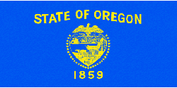
Oregon
State abbreviation/Postal code: Ore./OR Governor: Kate Brown, D (to Jan. 2019) Senators: Jeff Merkley, D (to Jan. 2021); Ron Wyden, D (to Jan. 2023) Historical biographies of Congressional members Organized as territory: Aug. 14, 1848 Entered Union (rank): Feb. 14, 1859 (33) Present constitution adopted: 1859 Motto: Alis volat Propriis (She flies with her own wings) (1987)
Nickname: Beaver State Origin of name: Unknown. However, it is generally accepted that the name, first used by Jonathan Carver in 1778, was taken from the writings of Maj. Robert Rogers, an English army officer. 10 largest cities (2010 est.): Portland, 583,776; Eugene, 156,185; Salem 154,637; Gresham, 105,594; Hillsboro, 91,611; Beaverton, 89,803; Bend, 76,639; Medford, 74,907; Springfield, 59,403; Corvallis, 54,462 Land area: 98,381 sq mi (254,806 km2) Geographic center: In Crook Co., 25 mi. SSE of Prineville Number of counties: 36 Largest county by population and area: Multnomah, 735,334 (2010); Harney, 10,135 sq mi. State forests: 780,000 ac. State parks: 231 (95,462 ac.) Residents: Oregonian 2016 resident population est.: 4,093,465 2010 resident census population (rank): 3,831,074 (27). Male: 1,896,002 (49.5%); Female: 1,935,072 (50.5%). White: 3,204,614 (83.6%); Black: 69,206 (1.8%); American Indian: 53,203 (1.4%); Asian: 141,263 (3.7%); Other race: 204,625 (5.3%); Two or more races: 144,759 (3.8%); Hispanic/Latino: 450,062 (11.7%). 2010 percent population 18 and over: 77.4; 65 and over: 13.9; median age: 38.4. |
Spanish and English sailors are believed to have sighted the Oregon coast in the 1500s and 1600s. Capt. James Cook, seeking the Northwest Passage, charted some of the coastline in 1778. In 1792, Capt. Robert Gray, in the Columbia, discovered the river named after his ship and claimed the area for the U.S.
In 1805 the Lewis and Clark expedition explored the area. John Jacob Astor's fur depot, Astoria, was founded in 1811. Disputes for control of Oregon between American settlers and the Hudson Bay Company were finally resolved in the 1846 Oregon Treaty, in which Great Britain gave up claims to the region.
In the agricultural sector, greenhouse and nursery products such as daffodils, gladioli, irises, lilies, peonies and tulips for bulbs are Oregon's most valuable. Hay is Oregon's second ranked crop generating 7% of the state's total agricultural receipts.
Ryegrass, wheat and onions are also valuable crops within the state. Oregon produces almost all of the country's seed for bentgrass, fescue, ryegrass, crimson clover, Kentucky and merion bluegrasses and orchardgrass. Oregon is a leader in the production of peppermint oil and Christmas trees.
With the low-cost electric power provided by dams, Oregon has developed steadily as a manufacturing state. Leading manufactured items are lumber and plywood, metalwork, machinery, aluminum, chemicals, paper, food packing, and electronic equipment. Following the high-tech component industry is the wood processing industry where manufactured products include plywood, veneer and particleboard. Oregon leads the states in lumber production.
Crater Lake National Park, Mount Hood, and Bonneville Dam on the Columbia are major tourist attractions. Other points of interest include the Oregon Dunes National Recreation Area, Oregon Caves National Monument, Cape Perpetua in Siuslaw National Forest, Columbia River Gorge between The Dalles and Troutdale, Hells Canyon, Newberry Volcanic National Monument, and John Day Fossil Beds National Monument.
In 2012's Gallup's ideological survey, Oregon was ranked the third bluest (most liberal) state behind Washington DC and Massachusetts. In another 2012 Gallup survey, Oregon placed near the bottom of the most religious states. Oregon placed fifth from the bottom, tying with Rhode Island and ahead of only four states, all located in New England. Meanwhile, state education officials reported that more than 20,000 students took at least one AP exam in 2012. That's a third of the graduating 2012 class and a 6.6 percent increase from 2011.
See more on Oregon:
Encyclopedia: Oregon
Encyclopedia: Geography
Encyclopedia: Economy
Encyclopedia: Government
Encyclopedia: History
Monthly Temperature Extremes
All U.S. States: Geography & Climate
Printable Outline Maps
Record Highest Temperatures
Record Lowest Temperatures
Highest, Lowest, and Mean Elevations
Land and Water Area
All U.S. States: Population & Economy
Historical Population Statistics, 1790–Present
Per Capita Personal Income
Minimum Wage Rates
State Taxes
Federal Government Expenditure
Percent of People in Poverty
Births and Birth Rates
Homeownership
Percentage of Uninsured by State
All U.S. States: Society & Culture:
Most Livable States
Healthiest States
Most Dangerous States
Smartest States
Crime Index
Residency Requirements for Voting
Compulsory School Attendance Laws
Driving Laws
National Public Radio Stations
Selected famous natives and residents:
- James Beard food expert;
- Raymond Carver writer and poet;
- Homer C. Davenport political cartoonist;
- David Douglas botanist;
- Abigail Scott Duniway women's suffrage advocate;
- John E. Frohnmeyer former chairman of the National Endowment for the Arts;
- Robert Gray sea captain and discoverer of Columbia River;
- Matt Groening cartoonist;
- Mark Hatfield senator;
- Donald P. Hodel secretary of the Interior;
- Chief Joseph Nez Percé chief;
- Dave Kingman baseball player;
- Ursula LeGuin writer;
- Courtney Love musician, singer, actor;
- Edwin Markham poet;
- Phyllis McGinley author;
- Linus Pauling chemist;
- River Phoenix actor;
- Jane Powell actor and singer;
- John Reed poet and author;
- Harvey W. Scott editor;
- Doc Severinsen band leader;
- Norton Simon business executive;
- Paul M. Simon Illinois senator;
- William E. Stafford poet;
- Sally Struthers actor;
- Corin Tucker musician, singer.


