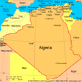
Algeria
Facts & Figures
-
President: Abdelmadjid Tebboune (2019)
Prime Minister: Ayman Benanderrahmane (2021)
Total area: 919,590 sq mi (2,381,741 sq km)
Population (2022 est.): 44,178,884 (growth rate: 1.34%); birth rate: 18.52/1000; infant mortality rate: 19.72/1000; life expectancy: 78.03
Capital and largest city (2022 est.): Algiers, 2.854 million
Other large cities: Oran, 922,000; Constantine, 530,100; Batna, 278,100; Annaba, 246,700
Monetary unit: Dinar
National name: Al Jumhuriyah al Jaza'iriyah ad Dimuqratiyah ash Sha'biyah
Ethnicity/race: Arab-Berber 99%, European less than 1%
Religion: Muslim (official; predominantly Sunni) 99%, other (includes Christian, Jewish, Ahmadi Muslims, Shia Muslims, Ibadi Muslims) <1% (2012 est.)
National Holiday: Revolution Day, November 1
Literacy rate: 81.4% (2018)
Economic summary: GDP/PPP (2020 est.): $468.4 billion; per capita $10,700. Real growth rate: 1.4%. Inflation: 1.9%. Unemployment: 11.7%. Arable land: 3.2%. Agriculture: wheat, barley, oats, grapes, olives, citrus, fruits; sheep, cattle. Labor force: 10.859 million; agriculture 10.8%, industry 30.9%, services 58.4% (2011 est.). Industries: petroleum, natural gas, light industries, mining, electrical, petrochemical, food processing. Natural resources: petroleum, natural gas, iron ore, phosphates, uranium, lead, zinc. Exports: $38.32 billion (2019 est.): petroleum, natural gas, and petroleum products 97%. Major trading partners (exports): Italy 13%, France 13%, Spain 12%, United States 7%, United Kingdom 7%, India 5%, South Korea 5% (2019). Imports: $54.26 billion (2019 est.): capital goods, foodstuffs, consumer goods. Major trading partners (imports): China 18%, France 14%, Italy 8%, Spain 8%, Germany 5%, Turkey 5% (2019).
Communications: Telephones: main lines in use: 4,784,306 (2020); mobile cellular: 45,555,673 (2020). Internet hosts: 676 (2012). Internet users: 27,626,15 (2020).
Transportation: Railways: total: 3,973 km (2014). Highways: total: 104,000 km; (2015). Ports and harbors: Algiers, Annaba, Arzew, Bejaia, Djendjene, Jijel, Mostaganem, Oran, Skikda. Airports: 149 (2021).
International disputes: Algeria and many other states reject Moroccan administration of Western Sahara; the Polisario Front, exiled in Algeria, represents the Sahrawi Arab Democratic Republic; Algeria's border with Morocco remains an irritant to bilateral relations, each nation accusing the other of harboring militants and arms smuggling; dormant disputes include Libyan claims of about 32,000 sq km still reflected on its maps of southeastern Algeria and the National Liberation Front's (FLN) assertions of a claim to Chirac Pastures in southeastern Morocco
