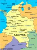
Geography
Colombia is bordered on the northwest by Panama, on the east by Venezuela and Brazil, and on the southwest by Peru and Ecuador. Through the western half of the country, three Andean ranges run north and south. The eastern half is a low, jungle-covered plain, drained by spurs of the Amazon and Orinoco Rivers, inhabited mostly by isolated tropical-forest Indian tribes. The fertile plateau and valley of the eastern range are the most densely populated parts of the country.
Government
Republic.
History
Little is known about the various Indian tribes who inhabited Colombia before the Spanish arrived. In 1510 Spaniards founded Darien, the first permanent European settlement on the American mainland. In 1538 they established the colony of New Granada, the area's name until 1861.
After a 14-year struggle, during which time Simón Bolívar's Venezuelan troops won the battle of Boyacá in Colombia on Aug. 7, 1819, independence was attained in 1824. Bolívar united Colombia, Venezuela, Panama, and Ecuador in the Republic of Greater Colombia (1819–1830), but he lost Venezuela and Ecuador to separatists. Two political parties dominated the region: the Conservatives believed in a strong central government and a powerful church; the Liberals believed in a decentralized government, strong regional power, and a less influential role for the church. Bolívar was himself a Conservative, while his vice president, Francisco de Paula Santander, was the founder of the Liberal Party.
Santander served as president between 1832 and 1836, a period of relative stability, but by 1840 civil war had erupted. Other periods of Liberal dominance (1849–1857 and 1861–1880), which sought to disestablish the Roman Catholic Church, were marked by insurrection. Nine different governments followed, each rewriting the constitution. In 1861, the country was called the United States of New Granada; in 1863 it became the United States of Colombia; and in 1885, it was named the Republic of Colombia.
In 1899, a brutal civil war broke out, the War of a Thousand Days, that lasted until 1902. The following year, Colombia lost its claims to Panama because it refused to ratify the lease to the United States of the Canal Zone. Panama declared its independence in 1903.
Rise of Rebel Groups M-19, ELN, FARC, and UAC
Marxist guerrilla groups organized in the 1960s and 1970s, most notably the May 19th Movement (M-19), the National Liberation Army (ELN), and the Revolutionary Armed Forces of Colombia (FARC), plunged the country into violence and instability. In the 1970s and 1980s, Colombia became one of the international centers for illegal drug production and trafficking, and at times the drug cartels (the Medillin and Cali cartels were the most notorious) virtually controlled the country. Colombia provides 75% of the world's illegal cocaine. In the 1990s, numerous right-wing paramilitary groups also formed, made up of drug traffickers and landowners. The umbrella group for these paramilitaries is the United Self-Defense Forces of Colombia (AUC).
Belisario Betancur Cuartas, a Conservative who assumed the presidency in 1982, unsuccessfully attempted to stem the guerrilla violence. In an official war against drug trafficking, Colombia became a public battleground with bombs, killings, and kidnappings. By 1989, homicide had become the leading cause of death in the nation. Elected president in 1990, César Gaviria Trujillo proposed lenient punishment in exchange for surrender by the leading drug dealers. Ernesto Samper of the Liberal Party became president in 1994. In 1996 he was accused of accepting campaign contributions from drug traffickers, but the House of Representatives absolved him of the charges.
Andrés Pastrana Arango was elected president in 1998, pledging to clean up corruption. In Dec. 1999, the Colombian military announced that 2,787 people were kidnapped that year—the largest number in the world—and blamed rebels. The murder rate soared in 1999, with some 23,000 people reported killed by leftist guerrillas, right-wing paramilitaries, drug traffickers, and common criminals. The violence has created more than 100,000 refugees, while 2 million Colombians have fled the country in recent years.
Joint Antinarcotics Effort with the United States, Plan Colombia, Begins
In Aug. 2000, the U.S. government approved “Plan Colombia,” pledging $1.3 billion to fight drug trafficking. Pastrana used the plan to undercut drug production and prevent guerrilla groups from benefiting from drug sales. In Aug. 2001, Pastrana signed “war legislation,” which expanded the rights of the military in dealing with rebels.
Alvaro Uribe of the Liberal Party easily won the presidential election in May 2002. He took office in August, pledging to get tough on the rebels and drug traffickers by increasing military spending and seeking U.S. military cooperation. An upsurge in violence accompanied his inauguration, and Uribe declared a state of emergency within a week. In his first year, Uribe beefed up Colombia's security forces with the help of U.S. special forces, launched an aggressive campaign against the drug trade, and passed several economic reform bills.
President Uribe Makes Strides in the Face of Significant Domestic Challenges
In May 2004, the UN announced that Colombia's 39-year-long drug war had created the worst humanitarian crisis in the Western Hemisphere. More than 2 million people have been forced to leave their homes and several Indian tribes are close to extinction. Colombia now houses the third-largest displaced population in the world, with only Sudan and the Congo having more. Uribe has produced some impressive results in fixing his country's ills, however. According to his defense minister, during 2003 more than 16,000 suspected leftist guerrillas and right-wing paramilitary vigilantes either surrendered, were apprehended, or were killed. Since 2003, the right-wing paramilitary group AUC has been involved in peace talks with the government, but despite demobilizing 4,000 troops, the vigilante group seemed as vigorous as ever in 2005. Although the two other major armed groups, left-wing FARC and ELN, continue to finance themselves through kidnapping and drug trafficking, governmental efforts have been successful in significantly reducing the kidnapping rate.
By 2006, the United States had invested $4 billion into Plan Colombia, the joint U.S.-Colombia coca antinarcotics plan begun in 2000. While officials say the program has eradicated more than a million acres of coca plants, Colombian drug traffickers are still managing to supply 90% of the cocaine used in the U.S. and 50% of the heroin—the same percentages supplied five years ago, when the program began. In 2006, a U.S. government survey acknowledged that coca production in the country had in fact increased by 26%, and that aerial spraying of the illegal crops—the primary strategy of Plan Colombia—was failing.
On May 28, 2006, President Uribe was reelected with 62% of the vote. Economic growth and a reduction in paramilitary violence were believed to be responsible for his landslide reelection. A controversy surrounding suspected ties between members of Uribe's government and paramilitary leaders dogged Uribe in late 2006 and into 2007.
In November 2007, the Colombian army captured FARC rebels who were carrying videos, photographs, and letters of about 15 hostages, some who have been held in jungle camps for nearly ten years. The Marxist-inspired FARC—the largest rebel group in Latin America—has been waging guerilla wars against the Colombian government for 40 years. Hostages included three American military contractors and Ingrid Betancourt, former Colombian presidential candidate. Also in November, Uribe withdrew his support of Venezuelan president Hugo Chavez’s attempts to negotiate with the FARC, escalating tension between the two countries. Chavez subsequently withdrew the Venezuelan ambassador to Colombia.
Venezuelan President Chavez Achieves Some Success in Releasing FARC-held Hostages
Months of negotiations between Chavez and FARC rebels over the release of three hostages came to an end on December 31, 2007, when the FARC refused to hand them over, saying the promised security conditions had not been met. On January 10, 2008, however, FARC rebels freed two hostages, Clara Rojas and Consuelo Gonzalez de Perdomo, in Guaviare, in southern Colombia. Rojas, a Colombian politician captured in 2002, and Perdomo, a Colombian lawmaker captured in 2001, were escorted out of the jungle by several guerillas. The release of the hostages was a triumph for Chavez, who coordinated the operation. On February 28, 2008, FARC rebels released four more Colombian hostages, all former members of Congress held in captivity for six years, after negotiations with President Chavez of Venezuela. The freed prisoners, three men and one woman, included Luis Eladio Perez, Orlando Beltran, Jorge Gechem, and Gloria Polanco de Losada.
On March 1, 2008, Colombian forces crossed into Ecuadorean territory and killed FARC rebel leader, Raúl Reyes, and 23 other rebels. In response, Venezuela and Ecuador broke off diplomatic relations with Colombia and sent troops to the Colombian borders, although both countries denied any ties to FARC. In an attempt to help cool the diplomatic tension between the three countries, the Organization of American States approved a resolution, which declared that the Colombian raid into Ecuador was a violation of sovereignty. On March 6, Nicaragua broke off diplomatic relations with Colombia to demonstrate unity with President Rafael Correa of Ecuador. On March 7, 2008, during a summit meeting in the Dominican Republic, the leaders of Colombia, Ecuador, Venezuela, and Nicaragua ended their diplomatic dispute over Colombia's raid into Ecuador.
On July 2, 2008, after being held for six years by FARC rebels, 15 hostages, including three U.S. military contractors and French-Colombian politician Ingrid Betancourt, were freed by commandos who infiltrated FARC's leadership. Four more FARC-held hostages were released in February 2009, including three Colombian police officers—Alexis Torres, Juan Fernando Galicia, and Jose Walter Lozano—and a Colombian soldier, William Rodriguez.
Political Veteran Assumes the Presidency
Former Defense Minister Juan Manuel Santos handily won the second round of presidential elections in June 2010, taking 69% of the vote. He promised to maintain the policies of former president Uribe, including the campaign against FARC guerrillas and forging a close relationship with the United States. Santos was largely responsible for planning and carrying out the government's successful assault on FARC.
In May 2014, Santos ran for re-election. He came in behind his main opponent, the Democratic Center Party's Óscar Iván Zuluaga in the first round when Zuluaga received 29.25% of the vote and Santos received 25.69%. Since neither had a majority, a run-off election was held the following month. During the run-off, Santos received support from the Conservative and Green parities as well as former rival, the Alternative Democratic Pole's Clara López Obregón. The support was enough to propel Santos to a victory with 53.1% over Zuluaga's 46.9%.
FARC Halts Kidnapping and Free Trade Agreement with the U.S. Begins
In late February 2012, FARC announced an end to its long time practice of kidnapping civilians for financial gains. The announcement was made on FARC's website. FARC, the chief rebel group in Colombia, also said it would soon free the remaining ten prisoners of war. The ten security force members have been held in captivity for 14 years. Unknown was whether FARC, also known as Revolutionary Armed Forces of Colombia, would release the kidnapped civilians they currently hold or whether the orders can be enforced among all the rebels in the group.
On May 15, 2012, the United States-Colombia Trade Promotion Agreement (CTPA) went into effect. Signed back on November 22, 2006, the agreement was made to eliminate tariffs and other trade barriers for goods and services between Colombia and the United States. Both countries worked together on resolving issues such as sanitary barriers in agriculture, including safety inspection procedures on certain food items. The agreement granted duty-free treatment to farm products and a variety of foods. Colombia should benefit from the deal considerably with at least a 10% increase to their exports, while creating new jobs and economic growth.
On June 15, 2014, Juan Manuel Santos won reelection with 53.1% of the vote and Oscar Ivan Zuluaga 46.9%. Turnout was 47.9%.
See also Encyclopedia: Colombia .
U.S. State Dept. Country Notes: Colombia
National Administrative Department of Statistics (DANE) (In Spanish only) www.dane.gov.co/ .