Zimbabwe
Facts & Figures
-
President: Robert Mugabe (1980)
Land area: 149,293 sq mi (386,669 sq km); total area: 150,804 sq mi (390,580 sq km)
Population (2014 est.): 13,771,721 (growth rate: 4.36%); birth rate: 32.47/1000; infant mortality rate: 26.55/1000; life expectancy: 55.68; density per sq mi: 57
Capital and largest city (2011 est.): Harare, 1.542 million
Other large cities: Bulawayo, 653,337; Chitungwiza, 356,840
Monetary unit: Zimbabwean dollar
Republic of Zimbabwe
Languages: English (official), Shona, Ndebele (Sindebele), numerous minor tribal dialects
Ethnicity/race: African 98% (Shona 82%, Ndebele 14%, other 2%), mixed and Asian 1%, white less than 1%
Religions: syncretic (part Christian, part indigenous beliefs) 50%, Christian 25%, indigenous beliefs 24%, Muslim and other 1%
Literacy rate: 83.6% (2011 est.)
Economic summary: GDP/PPP (2013 est.): $7.496 billion; per capita $600 (2013 est.). Real growth rate: 3.2%. Inflation: 8.5% (2013 est.). Unemployment: 95%. Arable land: 10.49%. Agriculture: corn, cotton, tobacco, wheat, coffee, sugarcane, peanuts; sheep, goats, pigs. Labor force: 3.939 million (2013); agriculture 66%, services 24%, industry 10% (1996). Industries: mining (coal, gold, platinum, copper, nickel, tin, clay, numerous metallic and nonmetallic ores), steel; wood products, cement, chemicals, fertilizer, clothing and footwear, foodstuffs, beverages. Natural resources: coal, chromium ore, asbestos, gold, nickel, copper, iron ore, vanadium, lithium, tin, platinum group metals. Exports: $3.144 billion (2013 est.): platinum, cotton, tobacco, gold, ferroalloys, textiles/clothing. Imports: $4.571 billion (2013 est.): machinery and transport equipment, other manufactures, chemicals, fuels, food products. Major trading partners: South Africa, China, Democratic Republic of Congo, Italy Botswana (2012).
Communications: Telephones: main lines in use: 301,600 (2012); mobile cellular: 12.614 million (2012). Radio broadcast stations: Government owns all local radio and TV stations; foreign shortwave broadcasts and satellite TV are available to those who can afford antennas and receivers; in rural areas, access to TV broadcasts is extremely limited (2007). Radios: 1.14 million (1997). Television broadcast stations: 16 (1997). Televisions: 370,000 (1997). Internet Service Providers (ISPs): 30,615 (2012). Internet users: 1.423 million (2009).
Transportation: Railways: total: 3,427 km (2008). Highways: total: 97,267 km ; paved: 18,481 km ; unpaved: 78,786 km (2002 est.). Waterways: Some navigation possible on Lake Kariba (2011). Ports and harbors: Binga, Kariba. Airports: 196 (2013).
International disputes: Namibia has supported, and in 2004 Zimbabwe dropped objections to, plans between Botswana and Zambia to build a bridge over the Zambezi River, thereby de facto recognizing a short, but not clearly delimited, Botswana-Zambia boundary in the river; South Africa has placed military units to assist police operations along the border of Lesotho, Zimbabwe, and Mozambique to control smuggling, poaching, and illegal migration.

Index
- Zimbabwe Profile
- History
- News and Current Events
Geography
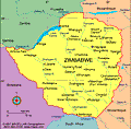
Zimbabwe, a landlocked country in south-central Africa, is slightly smaller than California. It is bordered by Botswana on the west, Zambia on the north, Mozambique on the east, and South Africa on the south.
History
The remains of early humans, dating back 500,000 years, have been discovered in present-day Zimbabwe. The land's earliest settlers, the Khoisan, date back to 200 B.C. After a period of Bantu domination, the Shona people ruled, followed by the Nguni and Zulu peoples. By the mid-19th century the descendants of the Nguni and Zulu, the Ndebele, had established a powerful warrior kingdom.
The first British explorers, colonists, and missionaries arrived in the 1850s, and the massive influx of foreigners led to the establishment of the territory Rhodesia, named after Cecil Rhodes of the British South Africa Company. In 1923, European settlers voted to become the self-governing British colony of Southern Rhodesia. After a brief federation with Northern Rhodesia (now Zambia) and Nyasaland (now Malawi) in the post–World War II period, Southern Rhodesia (also known as Rhodesia) chose to remain a colony when its two partners voted for independence in 1963.
White-Minority Government Declares Independence From Britain
On Nov. 11, 1965, the conservative white-minority government of Rhodesia declared its independence from Britain. The country resisted the demands of black Africans, and Prime Minister Ian Smith withstood British pressure, economic sanctions, and guerrilla attacks in his effort to uphold white supremacy. On March 1, 1970, Rhodesia formally proclaimed itself a republic. Heightened guerrilla war and a withdrawal of South African military aid in 1976 marked the beginning of the collapse of Smith's 11 years of resistance.
Black nationalist movements were led by Bishop Abel Muzorewa of the African National Congress and Ndabaningi Sithole, who were moderates, and guerrilla leaders Robert Mugabe of the Zimbabwe African National Union (ZANU) and Joshua Nkomo of the Zimbabwe African People's Union (ZAPU), who advocated revolution.
On March 3, 1978, Smith, Muzorewa, Sithole, and Chief Jeremiah Chirau signed an agreement to transfer power to the black majority by Dec. 31, 1978. They formed an executive council, with chairmanship rotating but with Smith retaining the title of prime minister. Blacks were named to each cabinet ministry, serving as coministers with the whites already holding these posts. African nations and rebel leaders immediately denounced the action, but Western governments were more reserved, although none granted recognition to the new regime.
First Multiracial Elections Held
The white minority finally consented to hold multiracial elections in 1980, and Robert Mugabe won a landslide victory. The country achieved independence on April 17, 1980, under the name Zimbabwe. Mugabe eventually established a one-party socialist state, but by 1990 he had instituted multiparty elections and in 1991 deleted all references to Marxism-Leninism and scientific socialism from the constitution. Parliamentary elections in April 1995 gave Mugabe's party a stunning victory with 63 of the 65 contested seats, and in 1996 Mugabe won another six-year term as president.
In 2000, veterans of Zimbabwe's war for independence in the 1970s began squatting on land owned by white farmers in an effort to reclaim land taken under British colonization—one-third of Zimbabwe's arable land was owned by 4,000 whites. In Aug. 2002, Mugabe ordered all white commercial farmers to leave their land without compensation. Mugabe's support for the squatters and his repressive rule has led to foreign sanctions against Zimbabwe. Once heralded as a champion of the anticolonial movement, Mugabe is now viewed by much of the international community as an authoritarian ruler responsible for egregious human rights abuses and for running the economy of his country into the ground.
Mugabe Runs Economy Into the Ground
In March 2002, Zimbabwe was suspended from the Commonwealth of Nations. That month Mugabe was reelected president for another six years in a blatantly rigged election whose results were enforced by the president's militia. In 2003, inflation hit 300%, the country faced severe food shortages, and the farming system had been destroyed. In 2004, the IMF estimated that the country had grown one-third poorer in the last five years.
Parliamentary elections in March 2005 were judged by international monitors to be egregiously flawed. In April, Zimbabwe was reelected to the UN Commission on Human Rights, outraging numerous countries and human rights groups. In mid-2005, Zimbabwe demolished its urban slums and shantytowns, leaving 700,000 people homeless in an operation called “Drive Out Trash.” In 2006, the government launched “Operation Roundup,” which drove 10,000 homeless people out of the capital.
Since 2000, Zimbabwe has experienced precipitous hyperinflation and economic ruin. By the end of 2008, inflation skyrocketed to a mind-boggling 231,000,000%, up from 7,000% in 2007, unemployment reached 80%, and the Zimbabwean dollar was basically worthless. According to the World Health Organization, Zimbabwe has the world's lowest life expectancy.
Mugabe Rigs 2008 Presidential Elections
Zimbabweans, clearly fed up with the economic collapse and the lack of available necessities in Zimbabwe, expressed their anger at the polls in March 2008's presidential and parliamentary elections. The opposition Movement for Democratic Change won a majority of the seats in Parliament, a remarkable defeat for Mugabe's party, ZANU-PF. Four days after the vote, Morgan Tsvangirai, the leader of Movement for Democratic Change, declared himself the winner by a slim margin. Mugabe refused to concede until the vote count was complete. More than a month after the election, howvever, the vote was not yet complete. Zimbabwe's HIgh Court dismissed the opposition's request for the release of election results. Many observers speculated that Mugabe ordered the delay to either intimidate election officials or to rig the results in his favor. Indeed, in April police raided the offices of the opposition and election monitors and detained dozens of people for questioning. After the election, supporters of Mugabe began a brutal campaign of violence against the opposition that left more than 30 people dead and hundreds wounded. Tsvangirai fled the country, fearing assassination attempts. He returned to Zimbabwe in late May.
On May 2, election officials finally released the results of the vote, with Tsvangirai defeating President Robert Mugabe, 47.9% to 43.2%. A runoff election was necessary because neither candidate won more than 50%. In the lead-up to the runoff election, police intensified their crackdown on Tsvangirai and members of his party. Indeed, at least 85 supporters of his party were killed in government-backed violence. Officials banned rallies and repeatedly detained Tsvangirai for attempting to do so. In addition, Tsvangirai’s top deputy, Tendai Biti was arrested on charges of treason. Biti denied he committed treason, and several members of Parliament alleged the charges were trumped up. In June, Mugabe barred humanitarian groups from providing aid in the country—a drastic move that aid organizations estimated would deny about two million people much-needed assistance. The ban on aid groups was lifted in September, and aid groups were correct in their prediction that the suffering of nearly two million Zimbabweans would intensify under the ban.
World Leaders Condemn The Election
The presidential election did take place in late June, but it was neither free nor fair. Nevertheless, Mugabe was elected to a sixth term, taking 85% of the vote. President Bush joined the chorus of world leaders who condemned the election and the government-sponsored crackdown on the opposition. China and Russia, however, blocked the U.S.-led effort in the UN Security Council to impose sanctions on Zimbabwe. Bush responded in July by expanding existing U.S. sanctions against Mugabe, companies in Zimbabwe, and individuals.
In August, Lovemore Moyo, national chairman of the opposition party Movement for Democratic Change, was elected to the powerful post of speaker of Parliament, 110 to 98, prevailing over the candidate of President Mugabe's party, ZANU-PF. It is the first time a member of the opposition holds the post since Zimbabwe gained independence in 1980.
Power-Sharing Agreement
President Mugabe and Tsvangirai agreed to a power-sharing deal in September that called on the leaders to share executive authority. Under the deal, Tsvangirai will serve as prime minister and the opposition will control 16 ministries. The governing party will control 15; Mugabe will continue as president. South African president Thabo Mbeki brokered the deal, but his close ties to Mugabe prompted observers and allies of Tsvangirai to question his neutrality. Both sides, however, balked at suggestions by negoitators that Mugabe and Tsvangirai share control over the Ministry of Home Affairs, which controls the police force, stalling implementation of the agreement. Talks dragged on for the remainder of 2008, but the two side failed to reach consensus.
As if life weren't unbearable enough in Zimbabwe, with its residents facing hunger, empty store shelves, a nonexistent health system, rampant unemployment, inflation a staggering 231 million percent, and the obvious political instability, a cholera epidemic broke out in August 2008. At least 565 people died from the disease by the end of the year, and another 12,000 were infected.
Tsvangirai agreed in January 2009 to enter into a power-sharing government with Mugabe, and he was sworn in as prime minister in February. Tsvangirai's Movement for Democratic Change assumed control 13 of the 31 ministries in the new government, while Mugabe's Zanu-PF was allocated 15. The parties share responsibility for the contested home-affairs ministry, which oversees the police. The relationship between Mugabe and Tsvangirai failed to improve, and they squabbled more than they governed. Mugabe didn't conceal his antipathy toward the power-sharing deal, and Tsvangirai accused Mugabe of thwarting any attempts at governing and for of inciting violence against his supporters.
One of their primary tasks was to draft a new constitution. After years of back and forth, Zanu-PF and the Movement for Democratic Change produced a draft constitution in January 2013. Voters approved the document in a March 2013 referendum. The constitution weakened the presidency by imposing term limits on future presidents, eliminating the president's veto power, and devolving power to the provinces. In addition, it expands civil liberties with a bill of rights and creates peace and reconciliation, election and anti-corruption commissions.
Mugabe Re-elected to a Seventh Term
Despite being looked upon unfavorably by the populace, Mugabe took 61% of the vote in presidential elections in July 2013, soundly defeating Tsvangirai. Mugabe's Zanu-PF party also won 158 out of 210 seats in parliament. Tsvangirai alleged the vote was rigged, but decided against challenging the results, saying he would not get a fair hearing.
Tsvangirai was suspended from his party, the Movement for Democratic Change, in May 2014. His detractors in the party denounced him for failing to defeat Mugabe in 2013's election and accused him of being an undemocratic and incompetent leader.
There was no shortage of drama in Zimbabwe in late 2014, as conspiracy theories and accusations hinted at a succession battle. The state-run newspaper published accusations that Vice President Joice Mujuru had conspired to have Mugabe assassinated, and Mugabe's wife, Grace, accused Mujuru of also trying to have her killed. Mujuru, a former guerrilla fighter in the country's war against white rule, was widely considered the successor to Mugabe. She dismissed the allegations as "ridiculous," and she professed her loyalty to Mugabe. Nevertheless, she was ousted from a seat on the governing party's central committee in early December. At the same time, Grace Mugabe was given a leadership position in the party, Zanu-PF. Then, Mugabe fired Mujuru and seven members of his cabinet. He replaced Mujuru with Justice Minister Emmerson Mnangagwa, an ally of Grace Mugabe. Observers speculated that Mugabe wants to ensure his loyalists remain in power after he dies.
Mujuru Announces New Party to Oppose Mugabe

President Robert Mugabe with his deputy Joice Mujuru, 2012
Source: AP Photo/Tsvangirayi Mukwazhi
In Sept. 2015, former Vice President Joice Mujuru released a political manifesto to position herself as a rival to President Mugabe in the 2018 elections. Part of her manifesto asked for a review of the legislation that has blocked foreign investment for the last ten years. "All persons who call Zimbabwe home shall be entitled to access land and participate in its sustainable utilization," the manifesto said. A former protege of Mugabe, Mujuru planned to launch her own party, People First, to take on his Zanu-PF.
The following month, the commander of Zimbabwe's Presidential Guard, Brigadier-General Anselem Sanyatwe, threatened to use violence to stop Mujuru from forming her new party. Already, the Joint Operations Command was closely monitoring Mujuru and her allies as they built structures and gathered volunteers to launch People First by the end of 2015.
See also Encyclopedia: Zimbabwe .
U.S. State Dept. Country Notes: Zimbabwe