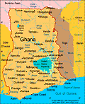
Ghana
Facts & Figures
-
President: John Dramani Mahama (2012)
Land area: 88,811 sq mi (230,020 sq km); total area: 92,456 sq mi (239,460 sq km)
Population (2014 est.): 25,758,108 (growth rate: 2.19%); birth rate: 31.4/1000; infant mortality rate: 38.52/1000; life expectancy: 65.75
Capital and largest city (2011 est.): Accra, 2.573 million
Other large cities: Kumasi, 2.019 million (2011)
Monetary unit: Cedi
Languages: Asante 14.8%, Ewe 12.7%, Fante 9.9%, Boron (Brong) 4.6%, Dagomba 4.3%, Dangme 4.3%, Dagarte (Dagaba) 3.7%, Akyem 3.4%, Ga 3.4%, Akuapem 2.9%, other (includes English (official)) 36.1% (2000 census)
Ethnicity/race: Akan 47.5%, Mole-Dagbon 16.6%, Ewe 13.9%, Ga-Dangme 7.4%, Gurma 5.7%, Guan 3.7%, Grusi 2.5%, Mande-Busanga 1.1%, other 1.6% (2010 census)
Religions: Christian 71.2% (Pentecostal/Charismatic 28.3%, Protestant 18.4%, Catholic 13.1%, other 11.4%), Muslim 17.6%, traditional 5.2%, other 0.8%, none 5.2% (2010 census)
National Holiday: Independence Day, March 6
Literacy rate: 71.5% (2010 est.)
Economic summary: GDP/PPP (2013 est.): $90.41 billion; per capita $3,500. Real growth rate: 7.9%. Inflation: 11%. Unemployment: 11% (2000 est.). Arable land: 20.12%. Agriculture: cocoa, rice, coffee, cassava (tapioca), peanuts, corn, shea nuts, bananas; timber. Labor force: 12.07 million (2013 est.); agriculture 56%, industry 15%, services 29% (2005 est.). Industries: mining, lumbering, light manufacturing, aluminum smelting, food processing, cement, small commercial ship building. Natural resources: gold, timber, industrial diamonds, bauxite, manganese, fish, rubber, hydropower, petroleum, silver, salt, limestone. Exports: $13.37 billion (2013 est.): oil, gold, cocoa, timber, tuna, bauxite, aluminum, manganese ore, diamonds. Imports: $14.03 billion (2011 est.): capital equipment, petroleum, foodstuffs. Major trading partners: Netherlands, Italy, UK, France, Germany, U.S., India, Singapore, Nigeria, China (2012).
Member of Commonwealth of Nations
Communications: Telephones: main lines in use: 285,000 (2012); mobile cellular: 25.618 million (2012). Broadcast media: state-owned TV station, 2 state-owned radio networks; several privately-owned TV stations and a large number of privately-owned radio stations; transmissions of multiple international broadcasters are accessible; several cable and satellite TV subscription services are obtainable (2007). Internet hosts: 59,086 (2012). Internet users: 1.297 million (2009).
Transportation: Railways: total: 947 km (2008). Highways: total: 109,515 km; paved: 9,955 km; unpaved: 52,266 km (2009). Waterways: 1,293 km; note: 168 km for launches and lighters on Volta, Ankobra, and Tano rivers; 1,125 km of arterial and feeder waterways on Lake Volta (2011). Ports and harbors: Takoradi, Tema. Airports: 10 (2013).
International disputes: disputed maritime border between Ghana and Côte d'Ivoire.
