- / World & News
- / Countries of the World
- / Syria
Syria
Facts & Figures
-
President: Bashar al-Assad (2000)
Prime Minister: Riyad Farid Hijab (2012)
Land area: 71,062 sq mi (184,051 sq km); total area: 71,498 sq mi (185,180 sq km)
Population (2014 est.): 17,951,639 (growth rate: -9.73%); birth rate: 22.76/1000; infant mortality rate: 15.79/1000; life expectancy: 68.41; density per sq mi: 306.5
Capital (2011 est.): Damascus, 2.65 million
Other large cities: Aleppo, 3.164 million; Hims, 1.369 million; Hamah, 933,000
Monetary unit: Syrian pound
National name: Al-Jumhuriyah al-'Arabiyah as-Suriyah
Languages: Arabic (official); Kurdish, Armenian, Aramaic, Circassian widely understood; French, English somewhat understood
Ethnicity/race: Arab 90.3%, Kurds, Armenians, and other 9.7%
Religions: Muslim 87% (official; includes Sunni 74% and Alawi, Ismaili, and Shia 13%), Christian (includes Orthodox, Uniate, and Nestorian) 10% (includes Orthodox, Uniate, and Nestorian), Druze 3%, Jewish (few remaining in Damascus and Aleppo)
Literacy rate: 84.1% (2011 est.)
Economic summary: GDP/PPP (2011 est.): $107.6 billion; per capita $5,100. Real growth rate: -2.3%. Inflation: 59.1% (2013 est.). Unemployment: 17.8% (2013 est.). Arable land: 24.9%. Agriculture: wheat, barley, cotton, lentils, chickpeas, olives, sugar beets; beef, mutton, eggs, poultry, milk. Labor force: 5.014 million (2013 est.); agriculture 17%, industry 16%, services 67% (2008 est.). Industries: petroleum, textiles, food processing, beverages, tobacco, phosphate rock mining, cement, oil seeds crushing, automobile assembly. Natural resources: petroleum, phosphates, chrome and manganese ores, asphalt, iron ore, rock salt, marble, gypsum, hydropower. Exports: $2.675 billion (2013 est.): crude oil, minerals, petroleum products, fruits and vegetables, cotton fiber, textiles, clothing, meat and live animals, wheat. Imports: $8.917 billion (2013 est.): machinery and transport equipment, electric power machinery, food and livestock, metal and metal products, chemicals and chemical products, plastics, yarn, paper. Major trading partners: Iraq, Saudi Arabia, China, Kuwait, Iran, UAE, Libya (2012).
Communications: Telephones: main lines in use: 4.425 million (2012); mobile cellular: 12.928 million (2012) Radio broadcast stations: AM 14, FM 2, shortwave 1 (2007). Radios: 4.15 million (1997). Television broadcast stations: 44 (plus 17 repeaters) (1995). Televisions: 1.05 million (1997). Internet Service Providers (ISPs): 416 (2012). Internet users: 4.469 million (2009).
Transportation: Railways: total: 2,052 km (2008). Highways: total: 69,873 km; paved: 63,060 km (including 1,103 km of expressways); unpaved: 6,813 km (2010). Waterways: 900 km; minimal economic importance. Ports and harbors: Baniyas, Latakia, Tartus. Airports: 90 (2013).
International disputes: Golan Heights is Israeli-occupied with the almost 1,000-strong UN Disengagement Observer Force patrolling a buffer zone since 1964; lacking a treaty or other documentation describing the boundary, portions of the Lebanon-Syria boundary are unclear with several sections in dispute; since 2000, Lebanon has claimed Shab'a Farms in the Golan Heights; 2004 Agreement and pending demarcation settles border dispute with Jordan.
Index
- Syria Profile
- History
- News and Current Events
Geography
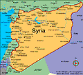
Slightly larger than North Dakota, Syria lies at the eastern end of the Mediterranean Sea. It is bordered by Lebanon and Israel on the west, Turkey on the north, Iraq on the east, and Jordan on the south. Coastal Syria is a narrow plain, in back of which is a range of coastal mountains, and still farther inland a steppe area. In the east is the Syrian Desert and in the south is the Jebel Druze Range. The highest point in Syria is Mount Hermon (9,232 ft; 2,814 m) on the Lebanese border.
Government
Republic under a military regime since March 1963.
History
Ancient Syria was conquered by Egypt about 1500 B.C., and after that by Hebrews, Assyrians, Chaldeans, Persians, and Alexander the Great of Macedonia. From 64 B.C. until the Arab conquest in A.D. 636, it was part of the Roman Empire except during brief periods. The Arabs made it a trade center for their extensive empire, but it suffered severely from the Mongol invasion in 1260 and fell to the Ottoman Turks in 1516. Syria remained a Turkish province until World War I.
A secret Anglo-French pact of 1916 put Syria in the French zone of influence. The League of Nations gave France a mandate over Syria after World War I, but the French were forced to put down several nationalist uprisings. In 1930, France recognized Syria as an independent republic but still subject to the mandate. After nationalist demonstrations in 1939, the French high commissioner suspended the Syrian constitution. In 1941, British and Free French forces invaded Syria to eliminate Vichy control. During the rest of World War II, Syria was an Allied base. Again in 1945, nationalist demonstrations broke into actual fighting, and British troops had to restore order. Syrian forces met a series of reverses while participating in the Arab invasion of Palestine in 1948. In 1958, Egypt and Syria formed the United Arab Republic, with Gamal Abdel Nasser of Egypt as president. However, Syria became independent again on Sept. 29, 1961, following a revolution.
In the Arab-Israeli War of 1967, Israel quickly vanquished the Syrian army. Before acceding to the UN cease-fire, the Israeli forces took control of the fortified Golan Heights. Syria joined Egypt in attacking Israel in Oct. 1973 in the fourth Arab-Israeli War, but was pushed back from initial successes on the Golan Heights and ended up losing more land. However, in the settlement worked out by U.S. secretary of state Henry A. Kissinger in 1974, the Syrians recovered all the territory lost in 1973.
In the mid-1970s Syria sent some 20,000 troops to support Muslim Lebanese in their armed conflict with Christian militants supported by Israel during the civil war in Lebanon. Syrian troops frequently clashed with Israeli troops during Israel's 1982 invasion of Lebanon and remained thereafter as occupiers of large portions of Lebanon.
Regional Conflicts Continue Through the End of the Century
In 1990, President Assad ruled out any possibility of legalizing opposition political parties. In Dec. 1991 voters approved a fourth term for Assad, giving him 99.98% of the vote.
In the 1990s, the slowdown in the Israeli-Palestinian peace process was echoed in the lack of progress in Israeli-Syrian relations. Confronted with a steadily strengthening strategic partnership between Israel and Turkey, Syria took steps to construct a countervailing alliance by improving relations with Iraq, strengthening ties with Iran, and collaborating more closely with Saudi Arabia. In Dec. 1999, Israeli-Syrian talks resumed after a nearly four-year hiatus, but they soon broke down over discussions about the Golan Heights.
On June 10, 2000, President Hafez al-Assad died. He had ruled with an iron fist since taking power in a military coup in 1970. His son, Bashar al-Assad, an ophthalmologist by training, succeeded him. He has emulated his father's autocratic rule.
In the summer of 2001, Syria withdrew nearly all of its 25,000 troops from Beirut. Syrian soldiers, however, remained in the Lebanese countryside.
Syria is Repeatedly Accused of Supporting Terrorist Groups
The U.S. imposed economic sanctions on the country in May, accusing it of continuing to support terrorism.
In Sept. 2004, a UN Security Council resolution asked Syria to withdraw its 15,000 remaining troops from Lebanon. Syria responded by moving about 3,000 troops from the vicinity of Beirut to eastern Lebanon, a gesture viewed by many as merely cosmetic.
On Feb. 14, 2004, Lebanon's former prime minister Rafik Hariri was assassinated. Many implicated Syria in the death of the popular and independent leader, who staunchly opposed Syrian involvement in Lebanon. Huge Lebanese protests called for Syria's withdrawal from the country, a demand backed by the U.S., EU, and UN. In addition to the anti-Syrian demonstrations, however, there were a number of massive pro-Syrian rallies in Lebanon sponsored by the Shiite militant group Hezbollah. By the end of April, Syria had withdrawn all its troops, ending a 29-year occupation. In October, the UN released a damning report on Hariri's slaying, concluding that the assassination was carefully organized by Syrian and Lebanese intelligence officials, including Syria's military intelligence chief, Asef Shawkat, who is the brother-in-law of President Assad. Syria vehemently denied the charges.
In July 2006, during the Hezbollah-Israeli conflict in Lebanon, Syria was strongly suspected of aiding Hezbollah.
Syria and Israel Begin Negotiating, but Terrorism and Conflict Continue
For the first time in eight years, Syria and Israel returned to the bargaining table in May 2008. Syria wants to regain control over the Golan Heights, which was taken by Israel in 1967, and Israel hopes an agreement will distance Iran from Syria and diminish some sway Iran holds over the Middle East. Syria also reached out to the West, meeting with French president Nicolas Sarkozy in July.
Assad met with Lebanese president Michael Suleiman in October 2008, and the two agreed that Lebanon and Syria would establish full diplomatic relations—for the first time since both countries gained independence from France in 1943.
In October, American Special Operations Forces launched an air attack into Syria, killing a leader of al-Qaeda in Mesopotamia near the Iraqi border. U.S. officials say the militant, Abu Ghadiya, smuggled weapons, money, and fighters into Iraq from Syria. The Syrian government accused the Americans of committing a war crime, saying that eight civilians, including a woman and three children, had been killed in the attack.
Relations between the U.S. and Syria thawed in December 2010 when President Barack Obama appointed diplomat Robert Ford as the ambassador to Syria. It was a recess appointment as Ford's confirmation was held up in the Senate. The U.S. hasn't had an ambassador to Syria since the 2005 assassination of Lebanese prime minister Rafik Hariri. Ford was quickly confronted with
Government Forces Crack Down on Protesters
The anti-government protest movement that swept through the Middle East in early 2011 also engulfed Syria. Syria, however, was spared the unrest until mid-March, when the arrest of about a dozen school-age children for painting anti-government graffiti in the southeast town of Dara'a sparked outrage, prompting citizens to take to the streets in protest. Demonstrations broke out throughout the country, with protesters calling for the release of political prisoners, an end to pervasive corruption, the lifting of the emergency law that has stood since 1963, and broader civil rights. On March 25, the government reneged on a promise not to use force against the protesters, opening fire on demonstrators in the south. As many as 60 people were killed.The political crisis deepened in the following days, and on March 29, President Assad's cabinet resigned. Massive protests and the crackdown by police continued, and by April 18 as many as 200 protestors had been killed. As the opposition movement gained strength, President Assad tried to balance suppression and compromise, offering some reform and lifting the emergence law while forbidding protests "under any banner whatsoever."
Assad in fact did attempt to thwart protests, deploying troops to several cities across Syria and brutally cracking down on protesters. By late May about 850 protesters had been killed by forces. The continued suppression led the Obama administration to impose sanctions on Assad and six other high-ranking officials. Assad intensified the attacks on protesters in early August, unleashing tanks, armored vehicles, and snipers on the restive city of Hama, historically a breeding ground for anti-government sentiment. By the end of the siege, casualties reached about 1,700. The particularly brutal assaults prompted widespread international condemnation, even from Syria's Arab neighbors. Indeed, Saudi Arabia, Bahrain, and Kuwait removed their ambassadors from Damascus. In mid-August, Obama issued a statement demanding that Assad resign and increased sanctions against Syria, freezing all Syrian assets held under U.S. jurisdiction and banning U.S. citizens and companies from doing business with the Syrian government. In addition, the UN released a report accusing Syria of crimes against humanity.
As international condemnation of Assad intensified, the opposition, which had previously lacked organization, in October formed the Syrian National Council, a diverse group of dissidents and opposition leaders who had the shared goal of ousting Assad. Turkey, once a close ally of Syria, endorsed the council and allowed members of the Free Syrian Army, a militia of army deserters, to set up camp within its borders. On Nov. 2, Assad agreed to a deal brokered by the Arab League to stop killing civilians, begin talks with the opposition, and withdraw forces from the streets. But Assad flouted the agreement and actually increased the attacks. In response, the Arab League suspended Syria's membership and later imposed sanctions on Syria, which included a travel ban on several high-ranking officials, the freezing of Syrian government assets in other Arab nations, and a halt on all commercial transactions with the Syrian government and central bank. It was the first time the group has taken such action against a member. In addition, King Abdullah of Saudi Arabia called for Assad to step down.
Diplomatic Effort to End Violence Stymied by Security Council Vetoes
As the fighting dragged on, several thousand soldiers defected and joined the Free Syrian Army, which was intensifying its attacks on government forces. The UN warned in December that Syria was on the brink of a civil war. "The Syrian authorities' continual ruthless repression, if not stopped now, can drive the country into a full-fledged civil war," said Navi Pillay, the UN commissioner for human rights. Arab League observers entered Syria in January to try to persuade Assad to stop attacking civilians, withdraw tanks from towns, and begin talks with the opposition. Despite their presence, the killing continued.
On Feb. 6, 2012, the U.S. government closed its embassy and withdrew personnel from Syria. Also in early February, Russia and China vetoed a UN Security Council resolution that called for an end to the violence, for Assad to hand power to his vice president, and the creation of a unity government. The vetoes were a clear blow to the diplomatic effort to stem the increasing violence. Days later, however, the UN General Assembly voted 137-12, in favor of a resolution that condemned Assad and urged him to step down. While the resolution was non-binding, it nevertheless was an embarrassment for the Syrian president. On the same day as the UN Security Council vote, Syrian forces unleashed a vicious assault on Homs, killing hundreds. The assault on Homs continued throughout the month, and after a vicious 27-day bombardment, the insurgents withdrew from Homs.
In late February, a UN panel accused the government of ordering "gross human rights violations" against civilians. The panel said the atrocities qualified as crimes against humanity. It also found that members of the Free Syrian Army were also guilty of using excessive violence, but their acts were "not comparable in scale and organization to those carried out by the state." On Feb. 26, a referendum on a new constitution, which set presidential term limits to two seven-year terms, passed with nearly 90% support. Outside observers called the referendum a farce. By the end of March, the UN estimated that about 9,000 people had been killed in the fighting.
On March 21, the UN Security Council issued a presidential statement backing a plan outlined by former UN Secretary-General Kofi Annan that largely mirrored the proposal brokered in Nov. 2011 by the Arab League, which called on the government to stop killing civilians, engage in talks with the opposition, withdraw forces from the streets, and "begin a transition to a democratic, political system." Russia and China, which had previously vetoed resolutions condemning Assad, endorsed the document. Assad accepted the statement and agreed to a cease-fire. He later said he would withdraw troops from cities by April 10. Many observers were skeptical, however, that he would make good on his promises. That doubt was justified in May, when about 110 people—including 49 children and 34 women—were killed in the village of Houla. UN observers blamed many of the deaths on government tanks and artillery and said many of the victims were executed in their homes. Assad, however, claimed terrorists carried out the attack. In response, 11 nations, including the U.S., expelled Syrian diplomats, and the UN Security Council unanimously criticized the "outrageous use of force" against residents and the government's role in the attack. Russia, typically protective of Syria and reluctant to criticize the government, signed on to the UN statement.
Syria Sinks into Civil War
The situation in Syria continued to deteriorate in the summer of 2012, with ongoing attacks against civilians—about 80 people were massacred in early June near Hama—and increased fighting between government troops and the opposition. In June, UN monitors abandoned their fact-finding mission after being attacked, and a UN official declared that Syria is in a state of civil war. In late June, Syria confirmed that its military forces shot down a Turkish military jet. The incident increased tension between the two countries. Turkey, a former ally of Syria, has thrown its support behind the Syrian rebels, and dozens of Syrian soldiers defected to Turkey.
Assad's regime suffered a withering blow on July 18, when a bomb went off at a meeting of senior ministers and security officials at the country's national security headquarters in Damascus, killing the defense minister and Assad's brother-in-law, a powerful member of the government. Several reports said the attack was an inside job, suggesting weaknesses in Assad's grip on power. Later in July, rebels and government troops battled for control of Damascus and Aleppo, Syria's largest city. Fighting was particularly brutal in Aleppo, as the government troops surrounded the city with tanks and fired on rebels from fighter jets and helicopters. As many as 200,000 people fled the embattled city. The government showed signs of strain as it attempted to fight the rebels in two major cities. While the government troops were criticized for their brutal tactics, the opposition also came under fire for reportedly torturing prisoners.
Muslim jihadists and members of Al Qaeda began to join the fight in the summer, backing the rebels with weapons and financing. The development prompted concern that the opposition would become dominated by extremists, pitting Sunnis against Shiites and the ruling Alawite minority.
Kofi Annan resigned as UN special envoy to Syria in August, citing the Syrian government's refusal to implement his peace plan, intensifying violence by rebels, and discord within the Security Council. He said "without serious, purposeful and united international pressure, including from the powers of the region, it is impossible for me, or anyone, to compel the Syrian government in the first place, and also the opposition, to take the steps necessary to begin a political process." He also said it is imperative that President Assad step down.
On August 6, Prime Minister Riyad Farid Hijab and at least two other ministers defected to Jordan and announced that they would support the opposition. They were the highest-level defections to date and were signs that Assad's hold on power was dwindling. Assad held fast, however, and stepped up attacks on the rebels and citizens. In one week in early August, residents of Daraya, a suburb of Damascus that is home to a large rebel population, said the military closed off the city, pounded it with gunfire and killed more than 600 residents.
By the end of the summer, the violence in Syria had claimed about 30,000 people, mostly civilians, about 250,000 people had fled the country, and some 1.2 million were internally displaced. Neither the rebels or the Assad regime were clearly winning the war. The rebels controlled wide swaths of the countryside, while the government maintained its grip on the country's biggest cities. President Barack Obama has resisted calls for U.S. intervention, saying he will not take military action unless Assad unleashes biological or chemical weapons.
In October 2012, the war in Syria was beginning to threaten the stability of other countries in the region. Militants from Lebanon-based Hezbollah were reportedly starting to help Assad fight the rebels, and relations between Syria and Turkey, former allies, deteriorated in October after a cross-border mortar attack from Syria killed five Turkish civilians. Turkey launched retaliatory attacks on targets in Syria. The Turkish Parliament then passed a motion that authorized military action as long as Syria continued to shell Turkey. If the fighting persists, NATO may intervene to protect Turkey, a member nation. The Turkish government, however said it did not want to go to war with Syria, but it would protect its borders as necessary militarily.
In addition, weapons sent to Syrian rebels from Saudi Arabia and Qatar had fallen into the hands of radical Islamic militants rather than the secular opposition—the intended recipients. The opposition began to lose support within Syria and in the international community as its attacks grew increasingly brutal and gratuitous and the emergence of the jihadists resulted lack of leadership and infighting among the rebels.
Opposition Forms New Governing Body
In November 2012, Syria's opposition groups agreed to form a new governing body that will unify the many rebel groups under one umbrella. The 50-person body, the Syrian National Coalition, will replace the Syrian National Council, which has come under fire for being largely ineffective and having few leaders living in Syria. The new organization will include younger leaders and will have strong representation inside the country. It will also oversee the opposition's military and will manage the distribution of weapons and funds. The group's leader, Sheikh Ahmad Moaz al-Khatib, a Sunni preacher who has said he is willing to negotiate with Assad, said he hoped the new body would be viewed with legitimacy and receive financial assistance and weapons from the international community. France and Turkey were the first countries to officially recognize the new coalition. The U.S. gave its imprimatur in December.
The military started to show signs of weakening in November and December. The opposition began using surface-to-air missiles to shoot down military planes and had taken over important military bases, and the military started to fire Scud missiles at the rebel fighters. Nevertheless, Assad dug in his heels and refused to budge. Some observers speculated that he had few—if any—options for survival. If he fled or stepped down, the Alawites feeling betrayed might turn on him, and by remaining in power he risked being killed by rebel fighters.
While most nations have refrained from sending troops to back the opposition, several, including the U.S. have sent financial and humanitarian aid. The U.S. has resisted direct involvement in the war to avoid giving Iran—a close ally of Syria—reason to intervene. In December, amid growing concern that Assad was preparing to unleash chemical weapons on the opposition, President Barack Obama said such a move would cross a "red line" and would merit a response.
In a speech in early January, Assad repeated that he would not negotiate with the rebels, who he labeled "terrorists," and that he had no intention of stepping down.
By the end of February 2013, about 70,000 people, mostly civilians, had been killed in the war, 700,000 people fled the country, and some 2 million people declared themselves internally displaced by the war.
The U.S. immersed itself more deeply in the war at the end of February, when U.S. secretary of state John Kerry traveled to Syria and announced an additional $60 million in aid to the opposition Free Syrian Army. The assistance will not come in the form of weapons but will include food aid, medical supplies, and materials to help beef up security and infrastructure.
In March, the opposition coalition elected Ghassan Hitto, a Syrian-born American computer executive who until recently lived in Texas, as prime minister of the opposition Syrian National Coalition. He returned to the Middle East, working out of Turkey, to help improve the flow of humanitarian aid to the rebels. He faces the daunting tasks of forming a cabinet to run the rebel-held regions, organizing the rebel groups, and distributing the aid to those groups. Many members of the coalition, however, opposed the election of Hitto, and Sheikh Ahmad Moaz al-Khatib resigned as president of the coalition. The turn of events left many wondering if the opposition coalition would survive the political turmoil. Despite the dissonance within the opposition, the Syrian National Coalition took Syria's seat at the summit meeting of the Arab League in March, with Khatib as its representative.
The Islamic State of Iraq and Syria (ISIS), a militant group made up of fundamentalist Sunni Muslims and linked to Al Qaeda, was formed in April 2013 and is active in both Iraq and Syria. Foreign jihadists compose the bulk of the organization, which believes that an Islamic state should be created in what is now Syria and Iraq and ruled by strict shariah law. ISIS has fought other rebel groups as well as government troops, further destabilizing Syria. It has overtaken several towns in northern Syria, and terrorized anyone who does not adhere to its ideology.
Several Countries Accuse Assad of Using Chemical Weapons
In April 2013, Israel's highest ranking intelligence analyst, Brig. Gen. Itai Brun, said he had evidence that Assad had used chemical weapons, specifically sarin, a deadly nerve agent, on rebels. That followed the assertion by France and England that Assad unleashed chemical weapons on rebel-held areas in Damascus, Aleppo, and Homs in March. The U.S. initially distanced itself from Israel's conclusion, but on April 25, U.S. Secretary of Defense Chuck Hagel said the intelligence community thinks—with varying degrees of confidence—that Assad had used chemical weapons. He said the U.S. would need confirmation before considering action against Assad. Given the lesson learned from Iraq, the U.S. is wary of rushing to intervene without incontrovertible evidence that the weapons had been unleashed. In June, the U.S. determined that Assad had used chemical agents b on a small scale against the opposition multiple times in the last yearb and said it would begin supplying arms and ammunition to the rebels. The Obama administration, however, said it would not give them anti-aircraft weapons, which the rebels have requested.
In early May 2013, Israel ordered two airstrikes on Damascus. Israeli officials maintained that the airstrikes were not meant as a way for Israel to become involved in Syria's ongoing civil war. Instead, the strikes focused on military warehouses in an effort to prevent Hezbollah, a Lebanese Shiite militia group with strong ties to Iran, from getting more weapons. Hassan Nasrallah, the leader of Hezbollah, declared at the end of May that the militant group was throwing its full support behind Assad and would send troops into Syria to fight alongside Syrian troops.
In May, the EU failed to renew the organization's arms embargo on Syria. The move suggested that some European countries may begin to arm the rebels.
Gains by Government and Splintering of Opposition Signal Staying Power of Assad
After months of holding the logistically important city of Al-Qusayr, which lies between Homs and the Lebanese border, the rebels fled the city in early June 2013 after being overrun by the Syrian army and Hezbollah fighters. Many rebels and citizens expressed outrage that Hezbollah turned its guns on fellow Muslims, citing Syria's support of Lebanon during its war with Israel.
The UN reported in early July that the death toll in the civil war had surpassed 100,000.
Ghassan Hitto stepped down as the prime minister of the opposition Syrian National Coalition in early July. He held the post for less than four months. Hitto made little progress in leading the rebels, and efforts to garner aid from the West fell short of expectations. His resignation came just days after Amad Jarba, a tribal leader from the northeastern part of the country, was elected president of the coalition. In September, the coalition elected Ahmad Saleh Touma, a dentist and political activist, as interim prime minister.
As the opposition showed signs of fracturing, Sunni versus Shiite violence intensified, and Assad's forces held on to Damascus, most of central Syria, and cities in the north with the help of Iran, Russia, and Hezbollah, the U.S. acknowledged in July 2013 that the president would likely remain in power and control parts of Syria indefinitely. In addition, support for the rebels began to wane when the Nusra Front, a radical Islamist militant group linked to al-Qaeda, joined the fight against Assad.
Assad Accused of Launching a Chemical Attack
On Aug. 21, 2013, opposition groups accused the government of attacking rebel areas in Zamalka, Ein Terma, and Erbeen, suburbs east of Damascus, with chemical weapons. Gruesome, graphic images in the media showed victims foaming at the mouth and twitching and lines of covered corpses. The opposition said as many as 1,000 people died in the attack. The government denied it launched a chemical attack. U.S. Secretary of State John Kerry called the attack a "moral obscenity" and an "indiscriminate slaughter of civilians." The alleged attack coincided with the arrival of UN inspectors to Syria to investigate earlier allegations of government use of chemical weapons. Inspectors were cleared to investigate the site, and their convoy was fired on by snipers en route. They did gain access to the affected areas and took samples for testing.
Because Russia and China vowed to veto any UN Security Council resolution authorizing retaliation on Assad, the U.S. and allies hoped to form a coalition to support an attack. President Obama said on Aug. 27 that he was considering a limited strike on the military bases and the artillery that he believes were responsible for the chemical attack, and French president Francois Hollande and British prime minister David Cameron backed Obama's plan. However, on Aug. 29, the British parliament voted down Cameron's request for authorization to attack Syria—a stunning setback to Cameron. On Aug. 31, the Obama administration released an intelligence summary that it said provided evidence that the Syrian government ordered the chemcial attack and that the assault killed 1,429 people. The intelligence summary reported that the military had been preparing for the attack for three days prior to the launch.
Obama surprised many on September 1, when he announced that he would seek Congressional approval for a military action. On Sept. 4, the U.S. Senate Foreign Relations Committee voted, 10 to 7, to authorize the action. In the following days, Obama attempted to rally support for the strike, but both the public and Congress expressed increasing reluctance for military action. A diplomatic solution was back on the table on Sept. 9, after U.S. secretary of state John Kerry suggested half-heartedly that a strike could be averted if Assad agreed to hand over all chemical weapons. Russia took the proposal seriously, and Russian foreign minister Sergey Lavrov said, "If the establishment of international control over chemical weapons in the country will prevent attacks, then we will immediately begin work with Damascus. And we call on the Syrian leadership to not only agree to setting the chemical weapons storage sites under international control, but also to their subsequent destruction." Syrian foreign minister Walid al-Moallem also embraced the option. "We are ready to reveal the locations of the chemical weapon sites and to stop producing chemical weapons and make these sites available for inspection by representatives of Russia, other countries and the United Nations," he said in a statement on Sept. 12. It was the first time the Syrian government acknowledged it had chemical weapons, and the country applied to join the the Chemical Weapons Convention. Given the uncertainty of Congressional authorization, diplomacy would spare Obama a potential rebuke that could undercut his authority for the remainder of his presidency.
On Sept. 16, the UN confirmed in a report that the chemical agent sarin had been used near Damascus on Aug. 21. "Chemical weapons have been used in the ongoing conflict between the parties in the Syrian Arab Republic, also against civilians, including children, on a relatively large scale," the report said. "The environmental, chemical and medical samples we have collected provide clear and convincing evidence that surface-to-surface rockets containing the nerve agent sarin were used." The report did not explicitly indicate who was responsible for launching the attack, but details about where the rockets that carried sarin originated from clearly pointed to government military positions. In particular, two rockets were fired from Mount Qasioun, an area in Damascus that protects Assad's presidential palace.
The five permanent members of the Security Council agreed on a resolution on Sept. 26 that requires Syria to either turn over or destroy all of its chemical weapons and production facilities by June 30, 2014. The agreement set several benchmarks Syria must meet before the 2014 deadline. If Syria fails to comply, then the Security Council will reconvene to determine repercussions, which could include military action or sanctions. The timetable is extremely aggressive; such disarmament typically takes years, not months. While the agreement delayed a Congressional vote on a military strike, the U.S. kept that possibility on the table. "If diplomacy fails, the United States remains prepared to act," Obama said. UN officials arrived in Syria in early October and began destroying equipment used to produce the chemical weapons. The Organization for the Prohibition of Chemical Weapons reported on Oct. 31 that Syria had met its first deadline to destroy all of the chemical weapons production and mixing facilities.
Splintering of Opposition, Rise of ISIS Cause Concern
The fragile coalition of opposition groups further splintered in late September 2013, when 11 rebel groups announced that they would no longer recognize the Syrian National Coalition, the dissident leadership that is based in Turkey. Instead, the groups said they would work together to establish sharia, or Islamic law, in Syria. The move signaled the rising power of groups affiliated with al-Qaeda—a troubling development. In December, the U.S. and Britain suspended non-lethal aid to the opposition after the Islamic Front, a group that severed ties with the moderate coalition backed by the U.S., confiscated equipment provided to the rebels by the U.S.
By December, the humanitarian crisis in Syria had worsened, with both rebels and government troops blocking the delivery of much-needed food and medical aid to civilians. The death toll had reached nearly 126,000 and some 3 million people had fled to other countries in the region. In January 2014, an enormous trove of images that revealed the unspeakable torture and starvation of thousands of civilians who had been held in Syrian jails were leaked to the media. The photographs had been smuggled out of Syria by a Syrian police photographer and handed over to the Qatari government. If authenticated, the images will likely be used as evidence of human rights violations in a trial against Assad.
The Islamic State of Iraq and Syria (ISIS), which continued to over-run rebel-held areas in northern Syria throughout 2013, started to face challenges from other rebel groups in Syria as a result of its brutal tactics and its focus on instituting its strict brand of Islam over ousting Assad. ISIS was accused of executing leaders of both the Free Syrian Army and Ahrar al-Sham, another rebel group. In January 2014, the Nusra Front joined with other rebels groups to drive ISIS from several cities, dealing the group a significant defeat. But the rebels' fight against ISIS compromised their war with government troops. However, ISIS recovered and by late summer, it had taken over areas in Aleppo province previously held by the rebels. Al Qaeda also distanced itself from ISIS because of the group's merciless attacks, including those against Muslims. With support on the wan in Syria, ISIS turned its focus to Iraq.
Some have speculated that if the Obama administration had armed the rebels in Syria, then ISIS may not have had an opening in Syria. "I cannot help but wonder what would have happened if we had committed to empowering the moderate Syrian opposition last year," said Rep. Eliot Engel (D-NY) in August 2014.
UN-Led Negotiations Begin in Geneva; Rebels Suffer Setbacks
Much-anticipated negotiations brokered by the UN between the Syrian government, members of the opposition, the U.S., Turkey, Saudi Arabia, and Russia began on Jan, 22, 2014, in Switzerland. UN Secretary-General Ban Ki-moon invited Iran at the last minute but then quickly uninvited Syria's closest ally when it refused to accept terms of the talks requiring Assad to step aside and allow for the formation of a transition government. While there was little hope for a peace agreement, just getting the parties to the table was considered progress. The UN succeeded where the negotiators failed and brokered a cease-fire between the Syrian government and rebels to allow the evacuatation of civilians from Homs who were stuck in the besieged city, cut off from humanitarian aid.
A second round of talks opened in Geneva in February and ended—without making any progress. U.S. officials criticized the Syrian government for its lack of commitment to the peace process and its continued crackdown on both civilians and rebels. "The regime stonewalled. They did nothing except continue to drop barrel bombs on their own people and continue to destroy their own country," said U.S. secretary of state John Kerry. "And I regret to say they are doing so with increased support from Iran, from Hezbollah and from Russia." The government has dropped barrel bombs—oil drums filled with explosives and metal shards that cause widespread devastation—on wide swaths of Aleppo, forcing nearly 500,000 people from Syria's largest city.
The government placed members of the opposition coalition on a list of terrorists and said the first step in the peace process must be ending terrorism. The opposition's top priority is setting up a transitional government, and presented a road map to put such a framework in place. The proposal did not specifically mention ousting Assad.
The UN Security Council unanimously passed a resolution in late February 2014 requiring that Syria allow relief agencies into the country to deliver humanitarian aid without attempting to impede or attack them. Addressing concerns of both the government and the opposition, the resolution also condemned the use of barrel bombs and terrorist attacks. While the resolution does not threaten sanctions for non-compliance (Russia would not have voted in favor of the resolution if it had), it does say "further steps" would be taken if the Syrian government is in violation.
In March 2014, government troops, with the help of Hezbollah, recaptured from the rebels the city of Yabroud, which is on the border with Lebanon and has been a key route for supplies from Lebanon. It was the last rebel stronghold in the area, handing the opposition another defeat. The fall of Yabroud followed that of Zara, another strategic city on the Lebanese border.
Assad Re-elected in a Disputed Election
In presidential elections held on June 3, 2014, Assad was re-elected to a third seven-year term, taking about 89% of the vote. However, votes were cast only in areas under government control as the opposition boycotted the election. President Obama and many other western leaders denounced the election as illegitimate.
Days after the election, Assad said he would grant amnesty to prisoners involved in the uprising who have been detained for "all crimes other than terrorism." It was not clear when they would be released and if the declaration would apply to members of the opposition, who Assad has referred to as terrorists.
Syria handed over the last of its declared chemical weapons in late June 2014, just making the deadline set in September 2013. While the Organization for the Prohibition of Chemical Weapons praised Syria for complying, especially during war time, it cautioned that Syria has yet to destroy its chemical weapon production facilities and there may still be undeclared weapons in the country. It is also investigating reports that Syria dropped bombs containing chlorine. While chlorine is not a banned substance, use of it as a weapon would violate the international chemical weapons treaty it signed in 2013.
Obama Authorizes Strikes on ISIS
As ISIS intensified its attacks in Iraq, took over large swaths of northern Iraq and Syria, and beheaded two American journalists, President Barack Obama said in September 2014 that he had authorized airstrikes against ISIS and would work with allies in the region to retake areas under ISIS control and decimate the terrorist group, which he has referred to as a "cancer." He was clear that he does not plan to deploy ground troops in the fight against ISIS. He also asked Congress to authorize money to fund and train moderate rebel groups in Syria to aid in the fight, which it did in late September. Obama authorized the airstrikes under the 2001 Authorization for Use of Military Force law, which allowed President George W. Bush to use "necessary and appropriate force" against those involved in the Sept. 11, 2001, terrorist attacks.
"ISIL poses a threat to the people of Iraq and Syria, and the broader Middle East—including American citizens, personnel and facilities," Obama said. "If left unchecked, these terrorists could pose a growing threat beyond that region, including to the United States. While we have not yet detected specific plotting against our homeland, ISIL leaders have threatened America and our allies." The White House uses the name Islamic State of Iraq and the Levant (ISIL).
Airstrikes began in Syria on Sept. 23, with Bahrain, Jordan, Qatar, Saudi Arabia, and the United Arab Emirates joining the U.S. in its campaign against ISIS bases and training camps in Raqqa, which is considered the group's capital, and four other provinces. The U.S. targeted another militant group in Syria, Khorasan, whose members make up "a network of seasoned Al Qaeda veterans" and are focused on attacking the U.S., according to U.S. Central Command. The Obama administration made clear that because the U.S. government and the Assad regime were fighting a common enemy, it did not change the U.S. view that Assad should step aside.
In September and October, ISIS laid siege to to Kobani, a Kurdish-dominated town in north-central Syria that borders Turkey, causing about 130,000 Kurdish refugees to flood into Turkey. The U.S. launched airstrikes on Kobani in early October, trying to prevent ISIS from taking over the strategically located town and gaining additional smuggling routes to arm fighters. The influx of refugees created a humanitarian crisis, and prompted Turkey to seal the border with Syria.
After five months of fighting, the Kurds—backed by 700 U.S.-led airstrikes—liberated Kobani from the grip of ISIS in January 2015. The victory came at an enormous cost, as the city was devastated by ISIS militants and the airstrikes. Some 400 Kurdish fighters were killed, and ISIS reportedly lost 1,000 jihadists in the fighting.
Peace Talks Delayed Again as Civil War Rages On; Another Attempt at Peace
The latest attempt at peace talks for Syria, mediated by the United Nations, began in Geneva on Feb. 1, 2016. The talks started the day after a suicide attack in Damascus killed more than 70 people. ISIS, which claimed responsibility for the attack, was not invited to the talks. Members of Syrian President Bashar al-Assad's government traveled to Geneva to participate along with major opposition groups.
However, two days later, the U.N. decided to suspend the talks, citing that there was more work to be done by everyone involved before progress can be made. During the press conference announcing the suspension, U.N. Special Envoy Staffan de Mistura said, "I have concluded, frankly, that after the first week of preparatory talks there is more work to be done, not only by us but by the stakeholders. I'm not prepared to have talks for the sake of talks." He also said that peace talks would resume by Feb. 25.
At a donor conference in London on Feb. 4, 2016, several countries came together to donate more than $10 billion in aid to Syria. The countries contributing include the United States, Germany, Norway, and Kuwait. The money would go toward helping the millions of people who have been forced to flee Syria because of the civil war.
The Syrian government and the opposition reached a truce agreement on Feb. 22, 2016. Under the terms of the deal, which was brokered by the United States and Russia, both sides agreed to a "cessation of hostilities," government-led forces will end their siege of rebel-held towns, and humanitarian aid will be delivered to those cities, which had been cut off from delivery of food and medicine. The Islamic State and the Nusra Front, an al-Qaeda affiliate based in Syria, were not part of the truce. They are two most extremist groups involved in the 5-year-long civil war. Few were optimistic the deal would hold.