DK People & Places: Mapping
A map is a picture that represents a particular part of the Earth’s surface, usually from above and at a reduced size. It can show the whole world, a single country, or the street where you live. Unlike a photograph, a map can give different kinds of information, such as place names, the elevation of the land, or the borders between countries.
The world is divided into 24 time zones, starting with Greenwich Mean Time (GMT) on the prime meridian. Countries to the east of this line are ahead of GMT, those to the west are behind. The 180° line of longitude is called the International Date Line. Places just west of this line are one day ahead of places to the east.
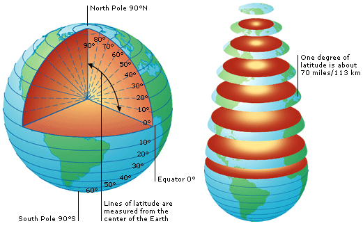
Imaginary lines drawn around the world to make a grid tell us exactly how far north, south, east, or west anywhere on Earth is. Horizontal lines of latitude run from east to west, parallel to the Equator which runs around the middle of Earth, and is given the value 0°. All other lines of latitude are numbered in degrees north or south of it. They measure how far north or south a place is.
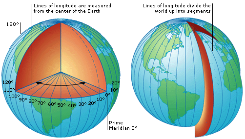
Vertical lines of longitude run between the North and South Poles. The prime meridian (numbered 0°) runs through Greenwich, England, and all other lines of longitude are numbered in degrees east or west of this line. The line opposite the prime meridian on the other side of the world is numbered 180°. Lines of longitude measure how far east or west a place is.