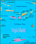
The Virgin Islands, consisting of nine main islands and some 75 islets, were explored by Columbus in 1493. They were originally inhabited by the Carib Indians. Since 1666, England has held six of the main islands; the remaining three (St. Croix, St. Thomas, and St. John), as well as about 50 of the islets, were eventually acquired by Denmark, which named them the Danish West Indies. In 1917, these islands were purchased by the U.S. from Denmark for $25 million.
Congress granted U.S. citizenship to Virgin Islanders in 1927. Universal suffrage was given in 1936 to all persons who could read and write English. The governor was elected by popular vote for the first time in 1970; previously he had been appointed by the U.S. president. A unicameral 15-person legislature serves the Virgin Islands, and congressional legislation gave the islands a nonvoting representative in Congress. Residents of the islands substantially enjoy the same rights as those enjoyed by mainlanders, but they may not vote in presidential elections.
Tourism is the primary economic activity, accounting for most of the GDP and 70% of employment. All goods made in the Virgin Islands qualify for duty-free entry into the United States.

