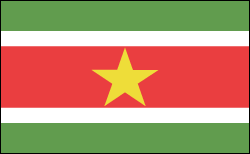
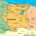
Suriname
Facts & Figures
-
President: Dési Bouterse (2010)
Vice President: Robert Ameerali (2010)
Land area: 62,344 sq mi (161,471 sq km); total area: 63,039 sq mi (163,270 sq km)
Population (2014 est.): 573,311 (growth rate: 1.12%); birth rate: 16.73/1000; infant mortality rate: 27.07/1000; life expectancy: 71.69; density per sq mi: 7.6
Capital and largest city (2011 est.): Paramaribo, 278,000
Monetary unit: Surinamese dollar
National name: Republiek Suriname
Languages: Dutch (official), English (widely spoken), Sranang Tongo (Surinamese, sometimes called Taki-Taki, is native language of Creoles and much of the younger population and is lingua franca among others), Caribbean Hindustani (a dialect of Hindi), Javanese
Ethnicity/race: East Indians (Hindustanis) 37%, Creole (mixed white and black) 31%, Javanese 15%, “Bush Negroes” (also known as Maroons) 10%, Amerindian 2%, Chinese 2%, white 1%, other 2%
Religions: Hindu 27.4%, Protestant 25.2% (predominantly Moravian), Roman Catholic 22.8%, Islam 19.6%, indigenous 5%
Literacy rate: 94.7% (2010 est.)
Economic summary: GDP/PPP (2013 est.): $7.12 billion; per capita $12,900. Real growth rate: 4.7%. Inflation: 4.2%. Unemployment: 9% (2008). Arable land: 0.36%. Agriculture: rice, bananas, palm kernels, coconuts, plantains, peanuts; beef, chickens; shrimp; forest products. Labor force: 165,600 (2007); agriculture 8%, industry 14%, services 78%. Industries: bauxite and gold mining, alumina production; oil, lumbering, food processing, fishing. Natural resources: timber, hydropower, fish, kaolin, shrimp, bauxite, gold, and small amounts of nickel, copper, platinum, iron ore. Exports: $2.512 billion (2013 est.): alumina, gold, crude oil, lumber, shrimp and fish, rice, bananas. Imports: $1.778 billion (2013 est.): capital equipment, petroleum, foodstuffs, cotton, consumer goods. Major trading partners: Norway, U.S., Canada, Belgium, France, UAE, Netherlands, Japan, China, Guyana, Antilles, Antigua and Barbuda, Brazil (2012).
Communications: Telephones: main lines in use: 83,000 (2012); mobile cellular: 977,000 (2012). Radio broadcast stations: AM 4, FM 13, shortwave 1 (2007). Radios: 300,000 (1997). Television broadcast stations: 2 (plus seven repeaters) (2007). Televisions: 63,000 (1997). Internet Service Providers (ISPs): 188 (2012). Internet users: 163,000 (2009).
Transportation: Railways: total: 166 km (single track) (2001). Highways: total: 4,304 km; paved: 1,130 km; unpaved: 3,174 km (2003). Waterways: 1,200 km; most important means of transport; oceangoing vessels with drafts ranging up to 7 m can navigate many of the principal waterways (2011). Ports and harbors: Paramaribo, Wageningen. Airports: 55 (2013).
International disputes: area claimed by French Guiana between Riviere Litani and Riviere Marouini (both headwaters of the Lawa); Suriname claims a triangle of land between the New and Kutari/Koetari rivers in a historic dispute over the headwaters of the Courantyne; Guyana seeks United Nations Convention on the Law of the Sea arbitration to resolve the longstanding dispute with Suriname over the axis of the territorial sea boundary in potentially oil-rich waters.