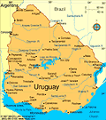
Uruguay
Facts & Figures
-
President: Luis Alberto Lacalle Pou (2020)
Land area: 67,035 sq mi (173,621 sq km); total area: 68,039 sq mi (176,220 sq km)
Population (2022 est.): 3,407,21 (growth rate: 0.27%); birth rate: 12.71/1000; infant mortality rate: 8.31/1000; life expectancy: 78.43
Capital and largest city (2022 est.): Montevideo, 1.767 million
Monetary unit: Uruguay peso
Oriental Republic of Uruguay
National name: República Oriental del Uruguay
Languages: Spanish (official)
Ethnicity/race: White 87.7%, Black 4.6%, Indigenous 2.4%, other 0.3%, none or unspecified 5% (2011 est.)
Religions: Roman Catholic 42%, Protestant 15%, other 6%, agnostic 3%, atheist 10%, unspecified 24% (2014 est.)
Literacy rate: 98.8% (2019 est.)
Economic summary: GDP/PPP (2020 est.): $75.06 billion; per capita $21,600. Real growth rate: 2.7%. Inflation: 7.8%. Unemployment: 7.6%. Arable land: 10.1%. Agriculture: soybeans, rice, wheat; beef, dairy products; fish; lumber, cellulose. Labor force (2017 est.): 1.748 million; agriculture 13%, industry 14%, services 73%. Industries: food processing, electrical machinery, transportation equipment, petroleum products, textiles, chemicals, beverages. Natural resources: arable land, hydropower, minor minerals, fish. Exports: $13.55 billion (2020 est.): beef, soybeans, cellulose, rice, wheat, wood, dairy products; wool. Major trading partners (exports): China 29%, Brazil 12%, United States 5%, Netherlands 5%, Argentina 5% (2019). Imports: $11.29 billion (2020 est.): refined oil, crude oil, passenger and other transportation vehicles, vehicle parts, cellular phones. Major trading partners (imports): Brazil 25%, China 15%, United States 11%, Argentina 11% (2019).
Communications: Telephones: main lines in use: 1,224,600 (2020); mobile cellular: 4,779,790 (2019). Radio broadcast stations: more than 100 commercial radio stations and about 20 TV channels; cable TV is available; many community radio and TV stations; adopted the hybrid Japanese/Brazilian HDTV standard (ISDB-T) in December 2010 (2019). Internet Service Providers (ISPs): 1.036 million (2012). Internet users: 2,987,405 (2020).
Transportation: Railways: 1,673 km (2016) (operational; government claims overall length is 2,961 km). Highways: total: 77,732 km; paved: 7,743 km; unpaved: 69,989 km (2010 est.). Waterways: 1,600 km; used by coastal and shallow-draft river craft (2011). Ports and harbors: Colonia, Fray Bentos, Juan La Caze, La Paloma, Montevideo, Nueva Palmira, Paysandu, Punta del Este, Piriapolis. Airports: 133 (2021).
International disputes: in 2010, the ICJ ruled in favor of Uruguay's operation of two paper mills on the Uruguay River, which forms the border with Argentina; the two countries formed a joint pollution monitoring regime; uncontested boundary dispute between Brazil and Uruguay over Braziliera/Brasiliera Island in the Quarai/Cuareim River leaves the tripoint with Argentina in question; smuggling of firearms and narcotics continues to be an issue along the Uruguay-Brazil border.